Stoddard County, Missouri - The National Weather Service in Paducah, Kentucky has issued a Special Weather Statement for Stoddard County, Missouri. Extreme cold temperatures this weekend through Tuesday.
... VERY COLD CONDITIONS ARE LIKELY FROM NEW YEAR'S EVE THROUGH TUESDAY
... BITTERLY COLD AIR WILL PUSH SOUTH INTO THE REGION THIS WEEKEND AND LAST THROUGH TUESDAY. VERY COLD TEMPERATURES COMBINED WITH STEADY NORTH TO NORTHWEST WINDS WILL RESULT IN DANGEROUSLY COLD WIND CHILL TEMPERATURES SATURDAY NIGHT THROUGH MONDAY NIGHT.
WIND CHILL TEMPERATURES FROM 0 TO 15 BELOW ZERO WILL BE COMMON, WITH THE COLDEST WIND CHILL TEMPERATURES EARLY NEW YEAR'S DAY MORNING.
WIND CHILL TEMPERATURES DURING THE DAY WILL GENERALLY BE IN THE SINGLE DIGITS TO JUST BELOW ZERO.
DUE TO THE EXTENDED COLD SNAP, PLAN TO REDUCE TIME SPENT OUTDOORS SUNDAY THROUGH TUESDAY, INCLUDING NEW YEAR'S DAY.
THESE CONDITIONS WILL INCREASE THE LIKELIHOOD OF HYPOTHERMIA AND FROST BITE.
ADVERSE IMPACTS TO INFRASTRUCTURE, SUCH AS PLUMBING, ARE LIKELY IF ADEQUATE STEPS ARE NOT TAKEN TO INSULATE EXPOSED PIPES.
CHECK ON THE ELDERLY, AND BE SURE TO MAKE ARRANGEMENTS FOR OUTDOOR PETS DURING THIS TIME OF VERY COLD WEATHER.
Weather provided by Bagby Wealth Management.

Southeast Missouri - Dry conditions throughout southeast Missouri have prompted several cities and counties to issue Burn Bans! If in doubt, don't burn until we see some significant rain!
Cape Girardeau County: Due to the combination of temperature, low humidity, dry ground covering, and the possibility of increasing winds, the Cape Girardeau County Commission issued a "no burn advisory" for Cape Girardeau County. All county residents are advised to postpone open outdoor burning until the fire danger decreases. If you are driving or working outdoors, be extremely careful to discard smoking materials. The grass along the highways is very dry and could easily ignite. Campers and hunters should be extremely careful.
Clarkton: The city of Clarkton, Missouri is under a no burn order until further notice. Anyone caught burning is subject to a fine plus court cost, according to Assistant Fire Chief Richard Blagg.
Holcomb: The Holcomb Fire Dept. has issued a burn ban until further notice. Anyone caught burning will be issued a citation according to Fire Chief Colleen Thompson. Contact authorities if you see anyone burning.
Madison County: A burn ban advisory was issued for Madison County, Missouri. Cherokee Pass Fire Chief Bill Starkey advises Madison County residents to not burn until further notice due to dry conditions and dry vegetation.
Puxico: A burn ban has been issued for the town of Puxico. Fire Chief Stacy Starnes advises residents not to burn until further notice.
Ripley County: The County Commission issued a no open burning order.
Scott City: A burn ban is in place until further notice.
Carter County Enacted 12/11/17 Until significant rainfall
Dent County Enacted 12/12/17 Expiring in 30 days
If your city has issued a burn ban, please let the ShowMe Times know by sending an email to news@showmetimes.com
When a county commission determines a burn ban is necessary, the county should also contact the Office of the State Fire Marshal by email at firesafe@dfs.dps.mo.gov for confirmation that the ban is appropriate. Please include a brief description of the danger(s) or hazard(s) threatening the county and be sure to include names, phone numbers, and email addresses in the event additional information is required.
For current drought conditions click HERE.

Stoddard County, Missouri - The National Weather Service in Paducah, Kentucky has issued a Wind Advisory until 4 p.m. Weather provided by Bagby Wealth Management.
... WIND ADVISORY REMAINS IN EFFECT UNTIL 4 PM CST THIS AFTERNOON
* TIMING... HIGHEST WIND GUSTS FROM MID MORNING THROUGH MID AFTERNOON.
* WINDS... FROM THE SOUTHWEST GUSTING TO AROUND 40 TO 45 MPH AT TIMES. THE STRONGEST WINDS ARE EXPECTED OVER SOUTHERN ILLINOIS AROUND MIDDAY.
* IMPACTS... DRIVING WILL BE MORE DIFFICULT FOR HIGH PROFILE VEHICLES. OUTDOOR OBJECTS, INCLUDING HOLIDAY DECORATIONS NOT SECURE MAY BE BLOWN AROUND OR DAMAGED. PRECAUTIONARY/PREPAREDNESS ACTIONS
... A WIND ADVISORY IS ISSUED WHEN SUSTAINED WINDS ARE EXPECTED TO REACH 30 MPH OR GREATER FOR LONGER THAN ONE HOUR... OR WIND GUSTS ARE EXPECTED TO REACH 40 MPH FOR ANY DURATION.
More Information
... WINDY CONDITIONS EXPECTED TODAY... .DEEP LOW PRESSURE WILL MOVE FROM THE UPPER MIDWEST SOUTHEAST TO THE OHIO VALLEY REGION TODAY. STRONG AND GUSTY SOUTHWEST WINDS WILL OCCUR OUT AHEAD OF AN APPROACHING COLD FRONT ASSOCIATED WITH THE LOW PRESSURE SYSTEM.
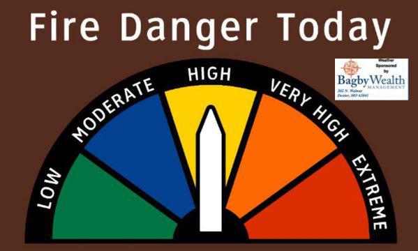
Stoddard County, Missouri - The National Weather Service has issued a Special Weather Statement until 4 p.m. Wednesday. Weather sponsored by Bagby Wealth Management.
SPECIAL WEATHER STATEMENT UNTIL 4PM CST WED
...ELEVATED FIRE DANGER TODAY
... THE COMBINATION OF STRONG GUSTY WINDS AND DRY VEGETATION WILL RESULT IN AN ELEVATED FIRE DANGER TODAY ACROSS THE QUAD STATE REGION. RELATIVE HUMIDITY WILL ALSO BE QUITE LOW AND MAY EVEN APPROACH RED FLAG CRITERIA THIS AFTERNOON, PARTICULARLY OVER THE OZARK FOOTHILLS OF SOUTHEAST MISSOURI.
THESE WEATHER CONDITIONS ALONG WITH VERY DRY GRASSES AND UNDERBRUSH COULD RESULT IN THE RAPID SPREAD OF FIRES. BURN BANS ARE IN EFFECT FOR SOME COUNTIES AND OUTDOOR BURNING IS HIGHLY DISCOURAGED ACROSS THE REGION. CHECK WITH LOCAL AUTHORITIES FOR THE LATEST ON AREA BURN BANS.
CONDITIONS SHOULD IMPROVE SIGNIFICANTLY BY SUNSET AS WINDS SLACKEN AND HUMIDITY RECOVERS.

Stoddard County, Missouri - Weather provided by Bagby Wealth Management - The National Weather Service in Paducah, Kentucky has issued a Special Weather Statement.
... STRONG GUSTY WINDS DEVELOPING BEHIND A COLD FRONT TONIGHT.
.. NORTHWEST WINDS HAVE INCREASED TO 20 TO 30 MPH WITH GUSTS AROUND 40 MPH ACROSS PARTS OF MISSOURI.
THESE STRONG WINDS ARE OCCURRING BEHIND A COLD FRONT, WHICH WILL CROSS THE LOWER OHIO VALLEY THIS EVENING.
AS THE FRONT PASSES THIS EVENING, EXPECT GUSTY NORTHWEST WINDS TO DEVELOP AND PERSIST FOR SEVERAL HOURS.
SOME LOCATIONS MAY EXPERIENCE GUSTS TO 40 MPH.
THIS WILL CAUSE SOME LOOSE OBJECTS TO BLOW AROUND, SUCH AS CHRISTMAS DECORATIONS. MOTORISTS MAY FIND VEHICLES DIFFICULT TO HANDLE, ESPECIALLY IN OPEN AREAS EXPOSED TO THE WIND.

Stoddard County, Missouri - A few shows are in the forecast for a very windy Saturday!
On Saturday, November 18, 2017 it will be windy with occasional rain in the morning then a few showers late. Thunder possible with a morning high of 68F. Temps will fall to near 50F. Winds will be West at 20 to 30 mph. Chance of rain 80%.
Saturday night will be clear with a low of 34F. Winds NW at 10 to 20 mph.
On Sunday, November 19, 2017 it will be mainly sunny skies. High near 49F and winds NW at 10 to 15 mph. Sunday evening will be clear with a low around 29F. Winds will be light and variable.

Stoddard County, Missouri - The National Weather Service in Paducah, Kentucky has issued a Tornado Watch until 10 p.m. for Stoddard County, Missouri.
THE NATIONAL WEATHER SERVICE HAS ISSUED TORNADO WATCH 513 IN EFFECT UNTIL 10 PM CST THIS EVENING FOR THE FOLLOWING AREAS IN ILLINOIS THIS WATCH INCLUDES 19 COUNTIES IN SOUTHEAST ILLINOIS EDWARDS IN SOUTHERN ILLINOIS ALEXANDER FRANKLIN GALLATIN HAMILTON HARDIN JACKSON JEFFERSON JOHNSON MASSAC PERRY POPE PULASKI SALINE UNION WABASH WAYNE WHITE WILLIAMSON IN INDIANA THIS WATCH INCLUDES 6 COUNTIES IN SOUTHWEST INDIANA POSEY IN SOUTHWEST INDIANA GIBSON PIKE SPENCER VANDERBURGH WARRICK IN KENTUCKY
THIS WATCH INCLUDES 7 COUNTIES IN WESTERN KENTUCKY BALLARD CRITTENDEN HENDERSON LIVINGSTON MCCRACKEN UNION WEBSTER IN MISSOURI THIS WATCH INCLUDES 7 COUNTIES IN SOUTHEAST MISSOURI BOLLINGER CAPE GIRARDEAU CARTER PERRY SCOTT STODDARD WAYNE THIS INCLUDES THE CITIES OF ALBION, BLOOMFIELD, BOONVILLE, CAIRO, CAPE GIRARDEAU, CARBONDALE, CARMI, DIXON, ELIZABETHTOWN, EVANSVILLE, FAIRFIELD, FORT BRANCH, GOLCONDA, GRAYVILLE, HARRISBURG, HENDERSON, HERRIN, JACKSON, JONESBORO, MARBLE HILL, MARION, MCLEANSBORO, METROPOLIS, MORGANFIELD, MOUND CITY, MOUNT CARMEL, MOUNT VERNON, MURPHYSBORO, PADUCAH, PERRYVILLE, PETERSBURG, PIEDMONT, PINCKNEYVILLE, POSEYVILLE, ROCKPORT, SHAWNEETOWN, SIKESTON, SMITHLAND, VAN BUREN, VIENNA, WEST FRANKFORT, WEST SALEM, AND WICKLIFFE.
Weather on ShowMe Times is sponsored by Bagby WEalth Management.

