
Wednesday, July 30, 2014
Weather brought to you by Montgomery Bank, a proud sponsor of the ShowMe Times.
Partly cloudy with temperatures steady or slowly rising into the upper 70s. High 79F. Chance of rain 10%. Winds SSW at 5 to 10 mph.
Sunset 8:08 p.m. Tonight mostly cloudy. Low near 65F. Humidity 82%. Winds light and variable. Chance of rain 10%.

Tuesday, July 29, 2014
Weather brought to you by Kathleen’s Treasure Cove, a proud sponsor of the ShowMe Times.
Mostly sunny today with a high of 81F. Winds N at 5 to 10 mph. Humidity low at 52%. Chance of rain zero.
Sunset 8:09 p.m. The days are already getting shorter! Tonight mainly clear skies with a near record low temperature 61F. Winds light and variable. Humidity will a little higher in the evening at 69%.

Monday, July 28, 2014
Weather brought to you by A & A Loans, a proud sponsor of the ShowMe Times.
Mostly sunny today with a high of 84F. Winds NNW at 10 to 15 mph. Hudmidity 60%. Chance of rain 0%.
Sunset 8:10 p.m. Tonight cloudy early, but will give way to mainly clear skies overnight. Low 59F. Winds N at 5 to 10 mph.
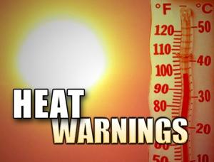
Stoddard County, Missouri - The National Weather Service in Paducah, Kentucky has issued a Weather Statement.
... HEAT INDEX VALUES 100 TO 105 THIS AFTERNOON...
AS TEMPERATURES WARM INTO THE LOWER AND MID 90S THIS AFTERNOON. THIS HEAT WILL COMBINE WITH HIGH HUMIDITY TO PRODUCE HEAT INDEX VALUES FROM 100 TO 105 DEGREES OVER MUCH OF THE SOUTHERN HALF OF THE FOUR STATE REGION. THE HEAT AND HUMIDITY SHOULD BEGIN TO SUBSIDE LATE IN THE DAY AS A COLD FRONT PUSHES THROUGH WESTERN KENTUCKY.
THIS LEVEL OF HEAT AND HUMIDITY WILL MAKE IT VERY UNCOMFORTABLE FOR THOSE WORKING OR PLAYING OUTDOORS THIS AFTERNOON. BE SURE TO DRINK PLENTY OF WATER... TAKE FREQUENT BREAKS AND WEAR LIGHT AND LOOSE FITTING CLOTHING.
COOLER WEATHER WILL RETURN TO THE QUAD STATE REGION ON MONDAY.

July 26, 2014
Weather brought to you by First Midwest Bank, a proud sponsor of the ShowMe Times.
A mixture of sun and clouds today with a heat index near 105F. Temperatures rising to 95F. Wins SSW at 10 to 20 mph. Chance of rain very little. Humidity 65%.
Sunset 8:11 p.m. Tongith a few clouds. A stray shower or thunderstorm is possible. Chance of rain 20%. Humidity74%. Low around 75F. Winds SSW at 5 to 10 mph.

Friday, July 25, 2014
Weather brought to you by SoutheastHEALTH of Stoddard County, a proud sponsor of the ShowMe Times.
A mixture of clouds and sunshine today with a high of 84F. Winds SSE at 5 to 10 mph.
Sunset 8:12 p.m. Tonight partly cloudy with a low of 67F. Winds will be light and variable.
Weekend forecast: Saturday and Sunday will see temperatures in the mid 90s. Very low chance of rain winds light and variable.

Thursday, July 24, 2014
Weather brought to you by Steven Mitchell, candidate for Associate Circuit Judge Division III, a proud sponsor of the ShowMe Times.
Sunny today with temperatures rising to 80F. Winds NNE at 10 to 15 mph.
Chance of rain zero. Humidity will be low during the day at 53%, but later this evening rise to 80%.
Sunset 8:13 p.m. Tonight mostly clear with near record low temperatures of 60F. Winds NNE at 5 to 10 mph.

