Stoddard County, Missouri – Weather brought to you by Southeast Health of Stoddard County, a proud sponsor of the ShowMe Times.
Monday – November 10th - Sunny with a high of 67F. Monday evening clear to partly cloudy with a slight chance of a shower late. Low 54F. Sunset 4:56 p.m.
Tuesday – November 11th – Veterans Day 2014 - Rain showers early with some sunshine later in the day. High 55F. Winds NW at 10 to 20 mph. Chance of rain 40%. Tuesday night will be clear skies with low 31F. Sunset 4:55 p.m.
Wednesday – November 12th – Cold front moves in! Mainly sunny skies with a high around 45F. Wednesday evening a few clouds from time to time with a low 28F. Sunset 4:54 p.m.
Thursday – November 13th – A few clouds early, otherwise mostly sunny. High 39F. Winds NNW at 10 to 15 mph. Thursday evening clear skies with a low 24F. Sunset 4:53 p.m.
Friday – November 14th – Plentiful sunshine with a high around 40F. Winds N at 5 to 10 mph. Friday evening mostly clear skies with a low of 24F. Winds light and variable. Sunset 4:52 p.m.
WEEKEND FORECAST
Saturday – November 15th – Some sun in the morning with increasing clouds during the afternoon. High 44F. Saturday evening scattered snow flurries and snow showers before midnight. Becoming partly cloudy later. Low around 30F. Chance of snow 30% Sunrise 6:39 a.m. Sunset 4:52 p.m.
Sunday – November 16th – Partly cloudy skies with a high near 40F. Winds NNW at 5 to 10 mph. Sunday evening partly to mostly cloudy with a low around 25F. Winds NNW at 5 to 10 mph. Sunrise 6:40 a.m. Sunset 4:51 p.m.
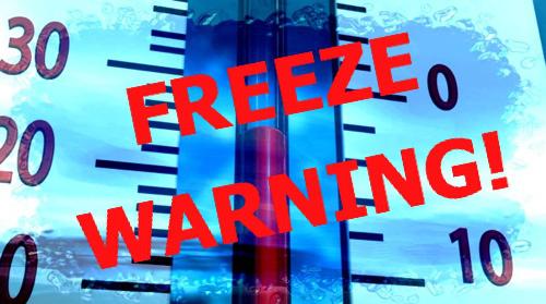
Stoddard County, Missouri - The National Weather Service in Paducah, Kentucky has issued a FREEZE Warning!
... FREEZE WARNING IN EFFECT FROM MIDNIGHT CDT FRIDAY NIGHT TO 8 AM CST SUNDAY...
THE NATIONAL WEATHER SERVICE IN PADUCAH HAS ISSUED A FREEZE WARNING... WHICH IS IN EFFECT FROM MIDNIGHT CDT FRIDAY NIGHT TO 8 AM CST SUNDAY. THE FREEZE WATCH IS NO LONGER IN EFFECT.
* TEMPERATURES WILL DROP BELOW AT OR BELOW THE FREEZING MARK BY MIDNIGHT FRIDAY NIGHT OVER SOUTHWEST ILLINOIS... THEN SPREAD SOUTHEAST ACROSS THE REST OF THE REGION THROUGH THE OVERNIGHT HOURS SATURDAY MORNING. TEMPERATURES SATURDAY MORNING WILL RANGE FROM 26 TO 31 DEGREES.
FOR SATURDAY NIGHT AND SUNDAY... TEMPERATURES SHOULD DROP BELOW FREEZING NO LATER THAN 10 PM CDT SATURDAY NIGHT... WITH LOWS RANGING BETWEEN 26 AND 32 DEGREES.
TEMPERATURES SHOULD RISE ABOVE FREEZING AFTER 9 AM CDT ON SATURDAY AND 8 AM CST ON SUNDAY.
* IMPACTS WILL BE TWOFOLD. COLD TEMPERATURES SATURDAY AND SUNDAY WILL DAMAGE SENSITIVE PLANTS LEFT UNCOVERED AND LEFT OUTDOORS. MODERATE TO HEAVY FROST EXPECTED SATURDAY NIGHT AND SUNDAY WILL ALSO DAMAGE PLANTS. THE COLD TEMPERATURES WILL PUT AN END TO THE OUTDOOR GROWING SEASON.
PRECAUTIONARY/PREPAREDNESS ACTIONS...
A FREEZE WARNING MEANS SUB-FREEZING TEMPERATURES ARE IMMINENT OR HIGHLY LIKELY. THESE CONDITIONS WILL KILL CROPS AND OTHER SENSITIVE VEGETATION.
More Information
... FIRST WIDESPREAD FREEZING TEMPERATURES OF THE SEASON EXPECTED THIS WEEKEND...
.CANADIAN HIGH PRESSURE WILL USHER IN MUCH COLDER AIR INTO THE QUAD STATE REGION BEHIND A COLD FRONTAL PASSAGE ON FRIDAY. AS THE WINDS DIMINISH AND SKIES CLEAR OUT... CONDITIONS WILL BE FAVORABLE FOR FREEZING TEMPERATURES LATE FRIDAY NIGHT INTO SATURDAY MORNING... AND AGAIN SATURDAY NIGHT INTO SUNDAY MORNING. ALTHOUGH FREEZING TEMPERATURES WILL BE THE PRIMARY CONCERN... WINDS WILL LIMIT FROST DEVELOPMENT FRIDAY NIGHT... BUT MODERATE TO HEAVY FROST WILL BE LIKELY LATE SATURDAY NIGHT.
Stoddard County, Missouri – Weather brought to you by Allen Christian Buick GMC, a proud sponsor of the ShowMe Times.
Monday, October 27th – A mix of clouds and sun this afternoon. Near record high temperatures. High 79F. Winds SSW at 15 to 25 mph. Tonight chance of scattered thunderstorms after midnight. Chance of rain 50%. Low 66F. Winds SSW at 10 to 15 mph.
Tuesday, October 28th – Thunderstorms in the morning will give way to partly cloudy skies late. Chance of rain 90%. High 67F. Tuesday evening will be partly cloudy with a low 48F. Winds light and variable.
Wednesday, October 29th – Sunny skies with a high 66F. Chance of rain 0%. Sunrise 7:21 a.m. Wednesday evening clear with a low of 42F.
Thursday, October 30th – Mostly sunny skies with a high of 67F. Chance of rain 0%. Sunrise 7:22 a.m. Thursday evening partly cloudy with a low of 48F. Sunset 6:05 p.m.
Friday, October 31st - Halloween - Mostly sunny skies with a high of 65F. Chance of rain zero! Sunrise 7:23 a.m. Friday evening clear with a low of 37F Sunset 6:04 p.m.

Issued by The National Weather Service
Paducah, KY
THE NATIONAL WEATHER SERVICE HAS ISSUED TORNADO WATCH 535 IN EFFECT UNTIL 7 PM CDT THIS EVENING FOR THE FOLLOWING AREAS
IN ILLINOIS THIS WATCH INCLUDES 17 COUNTIES
IN SOUTHERN ILLINOIS
ALEXANDER FRANKLIN GALLATIN HAMILTON HARDIN JACKSON JEFFERSON JOHNSON MASSAC PERRY POPE PULASKI SALINE UNION WAYNE WHITE WILLIAMSON
IN KENTUCKY THIS WATCH INCLUDES 13 COUNTIES
IN WESTERN KENTUCKY
BALLARD CALDWELL CALLOWAY CARLISLE CRITTENDEN FULTON GRAVES HICKMAN LIVINGSTON LYON MARSHALL MCCRACKEN TRIGG
IN MISSOURI THIS WATCH INCLUDES 11 COUNTIES
IN SOUTHEAST MISSOURI
BOLLINGER BUTLER CAPE GIRARDEAU CARTER MISSISSIPPI NEW MADRID PERRY RIPLEY SCOTT STODDARD WAYNE
THIS INCLUDES THE CITIES OF... BARDWELL... BENTON... BLOOMFIELD... CADIZ... CAIRO... CAPE GIRARDEAU... CARBONDALE... CARMI... CHARLESTON... CLINTON... DONIPHAN... EDDYVILLE... ELIZABETHTOWN... FAIRFIELD... GOLCONDA... HARRISBURG... HERRIN... HICKMAN... JONESBORO... MARBLE HILL... MARION... MAYFIELD... MCLEANSBORO... METROPOLIS... MOUND CITY... MOUNT VERNON... MURRAY... NEW MADRID... PADUCAH... PERRYVILLE... PIEDMONT... PINCKNEYVILLE... POPLAR BLUFF... PRINCETON... SHAWNEETOWN... SIKESTON... SMITHLAND... VAN BUREN... VIENNA... WEST FRANKFORT AND WICKLIFFE.

Monday, October 13th – Sunday, October 19th
This week’s weather brought to you by
Rainey-Mathis Funeral Home,
a proud sponsor of the ShowMe Times.
Monday, October 13th – Heavy thunderstorms may begin around 2:00 p.m.. Chance of rain 80%. Thunderstorms and wind likely with some locally heavy downpours, especially in the afternoon. A few storms may be severe. High 76F. Winds SSE at 20 to 30 mph. 1 to 2 inches of rain is expected. Low 60F. Humidity 95% in the evening.
Tuesday, October 14th – Chance of rain 50%. Winds SW at 12 mph. Humidity 90%. Sunrise 7:07 a.m. High 61F, Low 54F.
Wednesday, October 15th – Chance of rain 20%. Winds WNW at 11 mph. Humidity 87%. Mostly cloudy with a high of 59F, Low 51F.
Thursday, October 16th – Chance of rain 30%. Winds WSW at 7 mph. Humidity 68%. High 70F, Low 51F.
Friday, October 17th – Chance of rain 10%. Winds W at 8 mph. Humidity 66%. High 76F, Low 50F.
Saturday, October 18th – Sunny skies! Chance of rain zero. Winds WNW at 9 mph. High 69F, Low 48F. Beautiful!!!
Sunday, October 19th – Partly cloudy skies with zero chance of rain. High 68F, Low 51F. Becoming cloudy with a possibility of rain, 40% into the evening.

Monday, October 6th - Sunday, October 12th
This week's weather brought to you by
SoutheastHEALTH of Stoddard County,
a proud sponsor of the ShowMe Times.
Monday, October 6, 2014 – Isolated thunderstorms with some sunshine this afternoon. High 77F. Winds W at 10 to 15 mph. Chance of rain 30%. Sunset 6:36 p.m. Monday evening cloudy with scattered thunderstorms developing after midnight. Low 59F. Winds SW at 5 to 10 mph. Chance of rain 40%.
Tuesday – October 7, 2014 – Isolated morning thunderstorms. Chance of rain 60%. Winds W at 12 mph. High 83F Low 53F
Wednesday – October 8, 2014 – Rain will move out with mostly sunny. Chance of rain 0%. High 79F Low 53 F Wins WSW at 14 mph.
Thursday, October 9, 2014 – Scattered thunderstorms with a chance or rain 60%. High 78F Low 65F. Winds SSW at 10 mph.
Friday, October 10, 2014 – Showers with chance of rain 60%. Winds NNE at 11 mph. High 65F Low 53F
Saturday, October 11, 2014 – Scattered thunderstorms with a chance or rain 50%. High 64F Low 54F. Winds NE at 9 mph.
Sunday, October 12, 2014 – Scattered thunderstorms with chance or rain 60%. High 66F Low 56F. Winds SSW at 9 mph.

Monday, September 29th - Sunday, October 5th
This week’s weather brought to you by
Rainey-Mathis Funeral Home, a proud sponsor of the ShowMe Times.
Monday – Sunny with temperatures rising towards the mid 80s. Winds NNE at 5 to 10 mph. High 85F. A cool front will move in dropping temps in the mid-50s at night. Sunrise 6:53 a.m. Sunset 6:46 p.m. Zero percent chance of rain.
Tuesday – More of the same. Sunny with temperatures in the mid-80s. High 86F Low 59F Sunrise 6:54 a.m. Sunset 6:45 p.m.
Wednesday – Mostly sunny to partly cloudy. High 87F Low 69F Zero percent chance of rain.
Thursday – Thunderstorms are possible. Chance of rain 80%. High 83F Low 60F
Friday – Cool temperatures moving in with a high 76F low 49F. Slight chance of rain in the early hours. Sunny throughout the day.
Saturday – Beautiful weather with sunny skies high 76F low 49F
Sunday – More beautiful fall weather with mostly sunny skies high 70F low 48F.

