Submitted by
Dee Loflin, SMT Manager/Editor
Missouri - It may be common sense to most people, but even the most prepared forget to check something. It's always good to double check your list of "Things To Do to Be Prepared for Winter Weather".
To prepare for a winter storm you should do the following:
- Before winter approaches, add the following supplies to your emergency kit:
·
-
- Rock salt or more environmentally safe products to melt ice on walkways. Visit the Environmental Protection Agency for a complete list of recommended products.
- Sand to improve traction.
- Snow shovels and other snow removal equipment.
- Sufficient heating fuel. You may become isolated in your home and regular fuel sources may be cut off. Store a good supply of dry, seasoned wood for your fireplace or wood-burning stove.
- Adequate clothing and blankets to keep you warm.
- Make a Family Communications Plan. Your family may not be together when disaster strikes, so it is important to know how you will contact one another, how you will get back together and what you will do in case of an emergency.
- Listen to a NOAA Weather Radio or other local news channels for critical information from the National Weather Service (NWS). Be alert to changing weather conditions.
- Minimize travel. If travel is necessary, keep a disaster supplies kit in your vehicle.
- Bring pets/companion animals inside during winter weather. Move other animals or livestock to sheltered areas with non-frozen drinking water.
Winterize Your Vehicle
Check or have a mechanic check the following items on your car:
- Antifreeze levels - ensure they are sufficient to avoid freezing.
- Battery and ignition system - should be in top condition and battery terminals should be clean.
- Brakes - check for wear and fluid levels.
- Exhaust system - check for leaks and crimped pipes and rep
- Fuel and air filters - replace and keep water out of the system by using additives and maintaining a full tank of gas. A full tank will keep the fuel line from freezing.
- Heater and defroster - ensure they work properly.
- Lights and flashing hazard lights - check for serviceability.
- Oil - check for level and weight. Heavier oils congeal more at low temperatures and do not lubricate as well.
- Thermostat - ensure it works properly.
- Windshield wiper equipment - repair any problems and maintain proper washer fluid level.
- Install good winter tires - Make sure the tires have adequate tread. All-weather radials are usually adequate for most winter conditions. However, some jurisdictions require that to drive on their roads, vehicles must be equipped with chains or snow tires with studs.
Update the emergency kits in your vehicles with:
- a shovel
- windshield scraper and small broom
- flashlight
- battery powered radio
- extra batteries
- water
- snack food
- matches
- extra hats, socks and mittens
- first aid kit with pocket knife
- necessary medications
- blanket(s)
- tow chain or rope
- road salt and sand
- booster cables
- emergency flares
- fluorescent distress flag
Winterize Your Home
- Winterize your home to extend the life of your fuel supply by insulating walls and attics, caulking and weather-stripping doors and windows, and installing storm windows or covering windows with plastic.
- Winterize your house, barn, shed or any other structure that may provide shelter for your family, neighbors, livestock or equipment. Clear rain gutters; repair roof leaks and cut away tree branches that could fall on a house or other structure during a storm.
- Maintain heating equipment and chimneys by having them cleaned and inspected every year.
- Insulate pipes with insulation or newspapers and plastic and allow faucets to drip a little during cold weather to avoid freezing. Running water, even at a trickle, helps prevent pipes from freezing.
- All fuel-burning equipment should be vented to the outside and kept clear.
- Keep fire extinguishers on hand, and make sure everyone in your house knows how to use them. House fires pose an additional risk, as more people turn to alternate heating sources without taking the necessary safety precautions.
- Learn how to shut off water valves (in case a pipe bursts).
- Insulate your home by installing storm windows or covering windows with plastic from the inside to keep cold air out.
- Hire a contractor to check the structural ability of the roof to sustain unusually heavy weight from the accumulation of snow - or water, if drains on flat roofs do not work.
Carbon Monoxide
Caution: Carbon Monoxide Kills
- Never use a generator, grill, camp stove or other gasoline, propane, natural gas or charcoal¬ burning devices inside a home, garage, basement, crawlspace or any partially enclosed area. Locate unit away from doors, windows and vents that could allow carbon monoxide to come indoors.
- The primary hazards to avoid when using alternate sources for electricity, heating or cooking are carbon monoxide poisoning, electric shock and fire.
- Install carbon monoxide alarms in central locations on every level of your home and outside sleeping areas to provide early warning of accumulating carbon monoxide.
- If the carbon monoxide alarm sounds, move quickly to a fresh air location outdoors or by an open window or door.
- Call for help from the fresh air location and remain there until emergency personnel arrive to assist you.
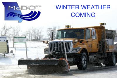
Submitted by
Dee Loflin, SMT Manager/Editor
The weekend forecast adds a level of difficulty for MoDOT's snowplow drivers, because the extreme cold and windy conditions may make it tougher to make progress and improve road conditions.
"At 30 degrees, one pound of salt will melt 46 pounds of ice, but that same pound of salt will melt less than four pounds of ice when it's zero degrees," said Beth Wright, MoDOT State Maintenance Engineer. "Add in the high winds that will blow snow back onto roadways, and we may face a truly challenging storm."
Those bitter temperatures don't just make plowing snow more difficult. They also make it more hazardous for crews and motorists. MoDOT employees take extra precautions to be safe from extremely cold temperatures, and so should motorists.
"If you have to travel during this storm, please be prepared and extra cautious," said Wright. "When temperatures dip this low, getting stranded on the side of the road can be very dangerous."
Before you travel, equip your vehicle with an emergency kit that includes:
a shovel, windshield scraper and small broom
a flashlight, battery powered radio, and extra batteries
water and snack food
matches
blankets, extra hats, socks and mittens
first aid kit with pocket knife and any necessary medications
tow chain or rope
road salt and sand
booster cables
emergency flares
fluorescent distress flag
Check out additional extreme cold weather tips from the Federal Emergency Management Agency at http://m.fema.gov/winter-storms-extreme-cold.
One of the best ways to prepare for winter travel is to check MoDOT's Traveler Information Map, located at www.modot.org. The map offers real-time views of road conditions for Missouri's interstates and major highways.
For smartphone and tablet users, MoDOT's Traveler Information App brings the same information to your mobile devices. Users can select road condition and work zone options from the map's legend, and view the same cameras and message boards found on desktop version of the map. The app is available for free at the iPhone App Store and Android Marketplace.
Travelers can also pick up the phone and call MoDOT's toll-free customer service center at 888-ASK-MODOT (888-275-6636). Customer service representatives are available to give road conditions updates 24 hours a day, seven days a week.
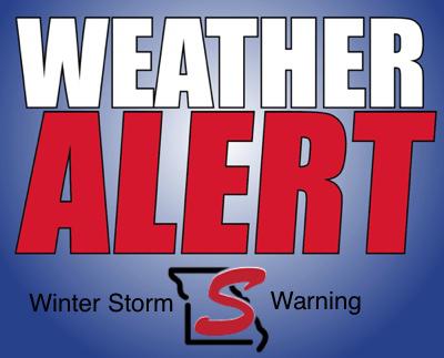
Dee Loflin, SMT Manager/Editor
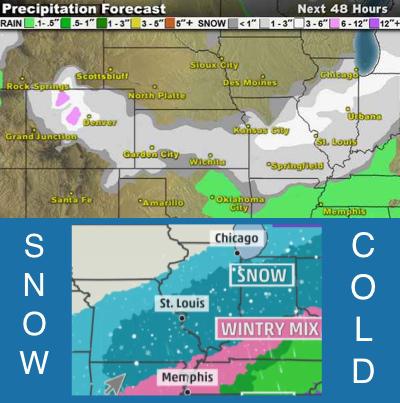
Stoddard County, Missouri - The National Weather Service has issued a Winter Storm Warning for our area beginning tonight.
.... WINTER STORM WARNING IN EFFECT FROM MIDNIGHT TONIGHT TO 6 PM CST SUNDAY...
THE NATIONAL WEATHER SERVICE IN PADUCAH HAS ISSUED A WINTER STORM WARNING FOR HEAVY SNOW... WHICH IS IN EFFECT FROM MIDNIGHT TONIGHT TO 6 PM CST SUNDAY. THE WINTER STORM WATCH IS NO LONGER IN EFFECT.
* TIMING: A MIX OF RAIN AND SNOW WILL SPREAD SOUTHEAST ACROSS MUCH OF SOUTHEAST MISSOURI AND SOUTHERN ILLINOIS FROM LATE SATURDAY NIGHT THROUGH DAYBREAK SUNDAY. THE TRANSITION TO ALL SNOW WILL HAPPEN QUICKLY OVERNIGHT IN AREAS NORTH OF A LINE FROM VAN BUREN MISSOURI TO MARION AND MT CARMEL ILLINOIS. THE TRANSITION TO SNOW WILL GRADUALLY SPREAD SOUTHEAST THROUGH THE REMAINDER OF THE AREA EARLY SUNDAY MORNING. THE SNOW WILL COME TO A RAPID END FROM WEST TO EAST SUNDAY AFTERNOON.
* AMOUNTS: AREAS NORTH OF A LINE FROM VAN BUREN MISSOURI TO MARION AND MT CARMEL ILLINOIS WILL SEE 1 TO 3 INCHES BY DAYBREAK SUNDAY. TOTAL SNOWFALL OVER SOUTHEAST MISSOURI AND SOUTHERN ILLINOIS WILL RANGE FROM 5 TO 10 INCHES. LOCALLY HIGHER AMOUNTS CAN BE EXPECTED.
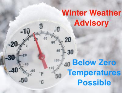
* IMPACTS: TRAVEL CONDITIONS WILL DETERIORATE LATE SATURDAY NIGHT AND THROUGH THE DAY SUNDAY. GUSTY NORTHWEST WINDS WILL BRING EXTREMELY COLD AIR INTO THE REGION SUNDAY THROUGH TUESDAY. TEMPERATURES WILL FALL BELOW ZERO OVER MUCH OF THE AREA LATE SUNDAY NIGHT AND REMAIN BELOW ZERO THROUGH THE DAY MONDAY AND INTO TUESDAY MORNING. WIND CHILL READINGS WILL RANGE FROM 10 BELOW TO 30 BELOW ZERO. SLICK ROAD CONDITIONS WILL LIKELY CONTINUE THROUGH THE FIRST HALF OF NEXT WEEK. ANY TRAVEL AND OUTDOOR ACTIVITY IS STRONGLY DISCOURAGED DUE TO THESE DANGEROUSLY COLD CONDITIONS.
PRECAUTIONARY/PREPAREDNESS ACTIONS...
A WINTER STORM WARNING FOR HEAVY SNOW MEANS SEVERE WINTER WEATHER CONDITIONS ARE EXPECTED OR OCCURRING. SIGNIFICANT AMOUNTS OF SNOW ARE FORECAST THAT WILL MAKE TRAVEL DANGEROUS. ONLY TRAVEL IN AN EMERGENCY. IF YOU MUST TRAVEL... KEEP AN EXTRA FLASHLIGHT... FOOD... AND WATER IN YOUR VEHICLE IN CASE OF AN EMERGENCY.
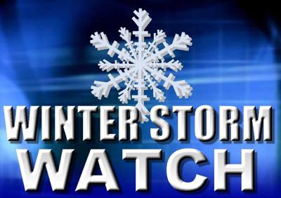
Submitted by
Dee Loflin, SMT Manager/Editor
. WINTER STORM WATCH IN EFFECT FROM SATURDAY EVENING THROUGH SUNDAY AFTERNOON...
THE NATIONAL WEATHER SERVICE IN PADUCAH HAS ISSUED A WINTER STORM WATCH... WHICH IS IN EFFECT FROM SATURDAY EVENING THROUGH SUNDAY AFTERNOON.
* KEEP IN MIND THIS IS A WATCH... BUT SIGNIFICANT SNOWFALL IS LOOKING INCREASINGLY LIKELY.
* TIMING: PRECIPITATION WILL BEGIN SATURDAY NIGHT. IT IS POSSIBLE THAT PRECIPITATION WILL BEGIN AS RAIN... ESPECIALLY THE FURTHER SOUTH YOU GO IN THE AREA... BUT IT SHOULD CHANGE OVER TO ALL SNOW AFTER MIDNIGHT.
* MAIN IMPACT: THE GROUND SHOULD BECOME WHITE OVERNIGHT... WITH SOME LOCATIONS PERHAPS RECEIVING UP TO A COUPLE INCHES BY SUNRISE SUNDAY. 4 TO 6 INCHES ON TOP OF THAT COMING SUNDAY MAKES FOR A STORM TOTAL FORECAST SNOWFALL ACCUMULATION OF 6 TO 8 INCHES FOR MOST OF THE WATCH AREA. LOCALLY HIGHER AMOUNTS ARE POSSIBLE.
* OTHER IMPACTS: EXTREME COLD WILL FOLLOW THESE SIGNIFICANT ACCUMULATIONS. TEMPERATURES WILL DROP THROUGH THE SINGLE DIGITS SUNDAY NIGHT AND WIND CHILLS WILL BE MINUS 10 TO MINUS 25 AT THEIR COLDEST MONDAY AND TUESDAY MORNINGS. THESE SIGNIFICANT SNOWFALL ACCUMULATIONS... IF REALIZED... WOULD THEREFORE STICK AROUND THROUGH AT LEAST MID WEEK.
PRECAUTIONARY/PREPAREDNESS ACTIONS...
A WINTER STORM WATCH MEANS THERE IS A POTENTIAL FOR SIGNIFICANT SNOW... SLEET... OR ICE ACCUMULATIONS THAT WOULD GREATLY IMPACT TRAVEL. STAY TUNED FOR LATER STATEMENTS. THIS WATCH WILL BE UPGRADED TO A WARNING IF WINTER STORM CONDITIONS BECOME MORE CERTAIN.
Submitted by
Dee Loflin, SMT Manager/Editor
Stoddard County, Missouri - The National Weather Service has in Paducah, Kentucky has issued a Special Weather Advisory for Stoddard County and surrounding counties.
WINTER STORM TO IMPACT THE REGION SATURDAY NIGHT AND SUNDAY... ... BRUTALLY COLD AIR TO FOLLOW MONDAY AND TUESDAY...
A POWERFUL WINTER STORM SYSTEM WILL SWING OUT OF THE SOUTHERN PLAINS SATURDAY NIGHT AND MOVE THROUGH THE LOWER OHIO VALLEY SUNDAY. A COLD FRONT WILL MOVE SOUTHEAST INTO THE AREA SATURDAY EVENING... AND THEN BRIEFLY STALL OUT NEAR THE OHIO RIVER SUNDAY MORNING BEFORE PUSHING RAPIDLY EAST OF THE AREA SUNDAY AFTERNOON.
WINTRY PRECIPITATION IS LIKELY TO BEGIN BEHIND THE FRONT LATE SATURDAY EVENING... AND THEN SPREAD SOUTH AND EAST OVER THE ENTIRE AREA BY DAYBREAK SUNDAY. THE PRECIPITATION SHOULD COME TO AN END AS PURE SNOW FROM WEST TO EAST SUNDAY AFTERNOON. AT THIS TIME... SIGNIFICANT SNOWFALL WILL BE POSSIBLE ESPECIALLY ALONG THE INTERSTATE 64 CORRIDOR. ELSEWHERE... THE PRECIPITATION IS LIKELY TO BEGIN AS RAIN OR A MIX OF RAIN... SLEET AND SNOW. HOW QUICKLY THE PRECIPITATION CAN CHANGE TO SNOW WILL BE PIVOTAL TO THE SNOWFALL TOTALS OVER THE REMAINDER OF THE AREA.
EXTREMELY COLD AIR WILL BEGIN TO SURGE ACROSS THE REGION SUNDAY... AND BY THE END OF THE DAY WIND CHILLS WILL LIKELY BE BELOW ZERO OVER MUCH OF SOUTHERN ILLINOIS. THIS WILL JUST BE THE BEGINNING OF THE COLD WEATHER.
AN ARCTIC OUTBREAK OF POTENTIALLY HISTORIC PROPORTIONS IS EXPECTED TO GRIP THE ENTIRE REGION SUNDAY NIGHT THROUGH TUESDAY MORNING. WIND CHILL VALUES ARE FORECAST TO RANGE FROM MINUS 10 TO MINUS 30 THROUGHOUT THIS TIME PERIOD. ACTUAL TEMPERATURES MAY STAY BELOW ZERO ALL DAY MONDAY IN SOUTHERN ILLINOIS AND SOUTHWEST INDIANA... AND ONLY REACH THE SINGLE DIGITS IN SOUTHEAST MISSOURI AND PARTS OF WESTERN KENTUCKY. THIS WOULD MAKE MONDAY THE COLDEST DAY SINCE EARLY FEBRUARY OF 1996... AND POSSIBLY THE COLDEST DAY ON RECORD. WITH THE SNOWFALL EXPECTED JUST AHEAD OF THIS ARCTIC AIR MASS... ANY TRAVEL PROBLEMS THAT ARISE WILL LIKELY LINGER THROUGH THIS PERIOD. EARLY PREPARATIONS ARE RECOMMENDED.
Dee Loflin, SMT Manager/Editor
.. BRUTALLY COLD WINTER STORM COMING IN LATE THIS WEEKEND...
GET READY FOR ANOTHER WINTER STORM... AND THIS ONE WILL BRING BRUTAL ARCTIC COLD NOT FELT HERE FOR YEARS. THIS SYSTEM COMES IN SATURDAY NIGHT AND SUNDAY WITH SNOW... OR RAIN CHANGING TO SNOW... THEN THE BRUTAL ARCTIC COLD COMES IN SUNDAY NIGHT AND MONDAY.
WE ARE TALKING ABOUT TEMPERATURES GOING BELOW FREEZING SUNDAY NIGHT... AND STAYING BELOW FREEZING FOR THE REST OF THE WEEK. AND NOT JUST BELOW FREEZING... BUT WAY BELOW!
HIGH TEMPERATURES ON MONDAY AND TUESDAY... THE COLDEST DAYS OF THE WEEK... ARE FORECAST IN THE SINGLE DIGITS AND TEENS. LOW TEMPERATURES DURING THIS TIME WILL BE NEAR ZERO OR EVEN IN THE NEGATIVE NUMBERS. ADD A LITTLE WIND TO THESE TEMPERATURES ON MONDAY AND TUESDAY... AND YOU HAVE WIND CHILL READINGS FROM MINUS 10 TO MINUS 20 AT TIMES.
A LOOK AT THE RECORD BOOKS SHOWS YOU HAVE TO GO BACK TO THE WINTER OF 1995-1996 FOR COLD OF THIS MAGNITUDE. STORM REPORTS REVEAL A HISTORICAL PERSPECTIVE THAT WE WOULD DO
WELL TO REMEMBER THIS TIME AROUND... SO LET'S LOOK BACK AT SOME OF THE THINGS THAT HAPPENED THEN WHEN A SIMILAR SYSTEM HIT THE AREA:
*SCORES OF PEOPLE WERE DEALING WITH DEAD CAR BATTERIES
*NUMEROUS WATER LINES BURST... BOTH IN HOMES AND EVEN MAIN TOWN SUPPLIES
*OVERWORKED FURNACES RESULTED IN OUTAGES
*NATURAL GAS SHORTAGES WERE REPORTED DUE TO DWINDLING SUPPLIES FROM PROLONGED COLD AND THE FREEZING UP OF GAS WELLS IN SOME LOCALES
*LOCAL POWER COMPANIES SET ALL TIME USAGE HIGHS
*HOUSE FIRES RESULTED AS SOME TRIED TO THAW THEIR PIPES
*ICE JAMS ON RIVERS... WHICH CAUSED BARGE TRAFFIC TO BACK UP AND EVEN CAUSED THE MISSISSIPPI RIVER TO RISE FURTHER SOUTH DOWNSTREAM. WHEN THE ICE BROKE DAYS LATER... MANY BARGES BROKE OFF THEIR MOORINGS AND HAD TO BE ROUNDED UP BY THE COAST GUARD. IN ADDITION... RIVER NAVIGATIONAL AIDS WERE DISPLACED OR DAMAGED BY THE ICE.
IT WOULD SERVE US ALL WELL TO REMEMBER THIS HISTORY... AND TRY TO TAKE THE NECESSARY PRECAUTIONS NOW TO BE PREPARED FOR ANOTHER SIMILAR BRUTALLY COLD OUTBREAK. IT IS POSSIBLE THAT THIS SYSTEM WILL ALSO PRODUCE SIGNIFICANT SNOWFALL... ALTHOUGH THAT IS STILL TOO EARLY TO SAY FOR SURE AT THIS TIME.
PREPARE NOW BECAUSE BARRING A MAJOR CHANGE TO THE FORECAST... THIS COLD IS COMING!

