Local News
Water Over Spillway; T Highway Cut In Two
May 02nd 2011 by News

By Annabeth Miller,
ShowMe Times Editor
WAPPAPELLO, Mo. – In the wee morning hours, the “unthinkable” happened at Lake Wappapello when a temporary berm built last week was topped, allowing lake water to begin flooding below Wappapello dam.
Dale Moreland of the Stoddard County EOS office reported that the topping of the dam began at about 2 a.m. At 6:30 a.m. Monday, Moreland reported the lake stage was at 398.13, with an expected crest later in the day at 399.2. Output early in the morning was at 14,000 cfs (cubic fee per second) and expected to exceed 23,450 cfs.
“During the flood of 1945, the largest output was at 18,600 cfs, and lake level was 398.979. So we are getting real close to those records.”
Moreland reported he received a report early Monday morning on the condition of T Highway, which crosses the spillway and dam.
“I received a report from a highway patrol troop at the scene that T Highway was already cut in two,” Moreland said.
Floodwaters from Wappapello will flood an area along the St. Francis River Basin south into Arkansas and as far east as possibly Highway F in Stoddard County. In anticipation of the flooding in the county, Moreland said Stoddard County Sheriff’s deputies and members of Stoddard County’s volunteer fire departments have gone door-to-door in the projected area.
“They have warned people that they may be flooded and that they may want to evacuate,” he said. The affected area could reach as far east as Highway F (Aid Road), south of Puxico and the Powe community. “Dudley will be affected.”
Moreland also said that the flooding from Wappapello would affect Highway 60, saying the major east-west highway would most likely be closed in different places from Fisk to the Aid Road. Heavy rains over the weekend dumped even more rain in the region, exasperating the situation. And almost like pouring salt onto a wound, an additional 3 – 4 inches of rain is expected Monday. Moreland said county emergency workers are watching the radar constantly for the new round of rain.
“The water is rising,” Moreland said. “It’s not going to be a gush. It will be a slow, gradual rise and it is rising at this time.”
Photo Above: Flooding waters escape over the berm at the emergency spillway at Lake Wappapello Monday morning. To the right in the photo, the damage to Highway T by the water is visible.
Last Updated on May 02nd 2011 by News
https://showmetimes.com/Blogpost/uik9/Water-Over-Spillway-T-Highway-Cut-In-Two
Corps Takes Additional Step In Floodway Process
May 01st 2011 by News
An SMT News Report
SIKESTON, Mo. - The U.S. Army Corps of Engineers is taking the final steps to activating the Birds Point New Madrid levee in Mississippi County. For the second time on Sunday afternoon, the Corps has taken a step in the activation process.
However, the officer in charge says that decision has still yet to be made.
Maj. Gen. Michael Walsh ordered crews on Sunday afternoon to move barges loaded with 250 tons of explosives across into position on the levey and to load the pipes with the explosive agent.
The final step would be to activate the floodway, which would send Mississippi River floodwaters through the breach in the levee and through the 130,000-acre floodway.
"The final decision to activate the floodway has not been made. Repeat - has not been made," the corps said in a release.
Last Updated on May 01st 2011 by News
https://showmetimes.com/Blogpost/uik8/Corps-Takes-Additional-Step-In-Floodway-Process
Second Step Take In Floodway Operation
May 01st 2011 by News

An SMT News Report
SIKESTON, Mo. - The U.S. Army Corps of Engineers will take the second step in the activation of the Birds Point New Madrid Floodway this Sunday afternoon.
Maj. Gen. Michael Walsh, President of the Mississippi River Commission, has directed Col. Vernie Reichling, U.S. Army Corps of Engineers Memphis District Commander, and field crews to be prepared to move to the next step in the Birds Point New Madrid Floodway operational plan at 3 p.m. today.
The second step in the operational plans involves repositioning the barges at Birds Point. These barges will contain the munitions that will be used to blast a breach in the floodway levee, thus activating the Birds Point floodway plan for only the second time since the 1937flood.
At 1 p.m. Sunday the river gauge at Cairo, Ill., measured 59.89 feet, reaching an historic level.
Widespread storms Saturday night contributed to a swift rise in the river level. At Cape Girardeau, 1.5 inches of rain was measured from storms Saturday night.
The Ohio River at Cairo rose 0.7 feet in the 24 hours before the early Sunday afternoon reading of the guage.
"The Project Flood is upon us," Maj. Gen. Michael Walsh, President of the Mississippi River Commission said today. "This is the flood that engineers envisioned following the 1927 flood. It is testing the system like never before."
Walsh said Public Safety is the Corps’ highest priority and that all resources are being used to battle the effects of this flooding. Hundreds of Corps’ personnel from around the nation as well as the Engineering Research Development Center, in Vicksburg, Miss., are working around the clock, monitoring the situation.
He added that he and his advisors are closely monitoring the situation but that no decision has been made at this time whether or not to operate the floodway. However, should flood pressures continue to increase it may be necessary to move to the next step in the Floodway Operations Plan.
Activating the floodway is multi-step process, with step one taken Saturday in moving the barges to Birds Point, and step two Sunday in repositing the.
The other steps in floodway operation include loading the pipes in the levee with slurry (explosives), and finally activating the floodway.
On Saturday, Welsh held a briefing with news media in Sikeston, and U.S. Rep. Jo Ann Emerson attended that briefing.
Walsh was scheduled to conduct a briefing at the Southeast Missouri Regional Port Authority in Scott city, with U.S. Senator Roy Blunt and Emerson both in attendance. That briefing was cancelled due to weather conditions.
Last Updated on May 01st 2011 by News
https://showmetimes.com/Blogpost/uik7/Second-Step-Take-In-Floodway-Operation
Corps: First Step Taken In Floodway Plan
April 30th 2011 by News
By Annabeth Miller,
ShowMe Times Editor
SIKESTON, Mo. - No official decision has been made to activate the Birds Point – New Madrid Floodway, but the commander in charge of floodfighting efforts said the first step was taken Saturday afternoon toward possible activation.
Major General Michael J. Walsh, commander of the Mississippi Valley Division of the corps and the president of the Mississippi River Commission, said at a press conference Saturday afternoon that he ordered the Motor Vessel Mississippi, a corps vessel, to leave Hickman, Kent., and travel up river to Birds Point.
“That’s one of the many decisions we make before - and if - we ever get to the decision of operating,” the floodway, Walsh said. The MV Mississippi arrived at Birds Point Saturday evening.
Walsh said three additional decisions must be made now that the barges have been moved to the northern end of the floodway at Birds Point: take the barges and “pre-position them; then the decision would be made to charge the pipes; and finally a decision to operate the floodway by blowing three gaps in the levee – one at the northern end at Birds Point and two down at the southern end of the system.
“There are still a lot of decision points as we move forward in this event,” Walsh said. “The decision clock has been rolling.”
If activated, the plan will be to artificially breach the levee in three places – one north and two south - by using of ammunition. The move will flood more than 130,000 acres of prime agriculture land in Missouri, but, the corps says, relieve pressure on a river system that has never experiences such high levels.
Walsh reported the Cairo river gauge - at the confluence of the great Mississippi and Ohio rivers - on Saturday afternoon was measuring 59.19 – not the highest ever recorded on the gauge but Walsh said it was close to the record of 59.5. The projection is that the level at Cairo will reach 60.5 for May 2 and 3.
“We’re keeping a close on that and we’re also keeping a close eye on the system,” he said. “This system has never been under this kind of pressure before and there’s different places where things are beginning to degrade. So we’re keeping track of the Cairo gauge and we’re also keeping track of the system.”
Walsh reported sand boils and seepage at a number of levees near the confluence of the Ohio and Mississippi rivers, a condition that Walsh said also threatens the integrity of the total project. The sand boils and seepage weakens the integrity of the levee.
 "There is water in places where we have never ever seen it before," Walsh said.
 U.S. Rep. Jo Ann Emerson, R-Cape Girardeau, was on hand for the briefing – one of her many stops in a day of checking on floodfighting throughout the region. She listened intently to what Walsh and other corps officials had to say – as well as to the area residents who attending. She was joined by State Rep. Ellen Brandom, R-Sikeston. Near the close of the briefing, a gentleman from the Commerce area asked Walsh about the integrity of the levee in his area and said he was trying to decide it he should move his family before flooding occurred at Commerce.
“What you tell me will determine my decision,” the man told Walsh.
Unlike other corps briefings this week that had a few members of area media in attendance, Saturday afternoon’s briefing was a “full house.” Several television outlets sent news crews, more newspapers joined the group of journalists, and a national telephone network was set up for those not in Sikeston to participate. One reporter on the telephone hookup identified herself from CNN-News.
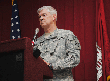
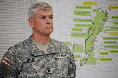
Photos Above: Major General Michael J. Walsh, Commander, Mississippi Valey Division, U.S. Army Corps of Engineers, and President, Mississippi River Commission
Follow the Corps of Engineers:
- On Twitter: http://twitter.com/#!/MemphisDistrict
- On Facebook: http://www.facebook.com/pages/Birds-Point-New-Madrid-Floodway-Joint-Informati on-Center/120898681323357?sk=wall
Last Updated on April 30th 2011 by News
https://showmetimes.com/Blogpost/uik6/Corps-First-Step-Taken-In-Floodway-Plan
Dexter Celebrates Honor Tour
April 29th 2011 by News

By Annabeth Miller,
ShowMe Times Editor
They were from communities like Dexter, Bloomfield, Essex, Poplar Bluff, and Cape Girardeau. And as young men they put their lives on the line in p Bastogne, Normandy, Sicily, in the Coral Sea and at Midway, and in the skies over Dresden, and at places like Pointe du Hoc and Omaha Beach.
Today, they are living testaments to the courage, conviction, bravery and tenacity that saved the Free World six decades ago.
And on Friday, the area came to salute them, their generation and a group departing on a different type of “tour of duty” – the Honor Tour for veterans of World War II. It was a patriotic rally unlike most any other; a multi-generational celebration of America and the men and women who fought for their country.
The Bearcat Event Center was “filled to the rafters” with students, families, fellow veterans, friends and community leaders to salute the 30 men who departed on an Honor Tour of Washington, D.C. to see “their” memorial – the National World War II Memorial.
School children from Southwest and Central schools marched into the BEC like young soldiers – all with white shirts with the American flag – and sat on one side of the BEC, while middle school and DHS students on the opposite side. The DHS Jazz band and the Honors Choir both participated, and high school students carried American flags and served as escorts. .
A large group of Dexter High School students formed two long lines down the center aisle of the BEC with large American flags to create a walkway for Honor Tour veterans walked through on the way to seats of honor. The DHS Jazz Band under the direction of Scott Rybolt played “2001 Space Odyssey” and “In The Mood.” Seated behind the Honor Tour men were their families and fellow veterans.
On the program were Dexter Supt. Dr. Thomas Sharp, U.S. Rep. Jo Ann Emerson, State Sen. Rob Mayer, State Rep. Billy Pat Wright and Jennifer Kasten of U.S. Senator Roy Blunt’s staff.
U.S. Rep. Jo Ann Emerson told the group that she had hoped to be in Washington, D.C. this weekend to greet them at the World War II Memorial. However she has been in the area all week and will be here through the weekend to work with constituents and agencies fighting the flood.
“Here among all the folks in Dexter - this is the heart and soul of America,” she said. “We are here today because of each and every one of you. None of you would ever call yourselves heroes. But we can call you heroes because in your humbleness you have watched out for us, you have given us all the tools that we have to carry on and make a much better community and a much better country. We thank you for your service to our country and the sacrifice that you made.”
Emerson said she hoped the travelling veterans would remember that when they get off the bus at the World War II Memorial that that memorial was a “small token” to thank and honor their service and for “serving as role models for your children and grandchildren.”
Guest speaker for the morning was Charles Kruse, Dexter High School graduate, area farmer, former president of the Missouri Farm Bureau and a retired brigadier general in the Missouri National Guard.
“Today, Dexter, Missouri is standing tall,” Kruse said He commended Sharp and the school district’s administration and faculty for their work in planning the ceremony. “The Dexter Public School s has really made a great showing here and made us all proud.”
Kruse noted that the chairman of the community committee that planned Friday morning’s event, Dr. Roger Alsup, was unable to attend the ceremony. Alsup is the principal at T.S. Hill Middle School and is a veteran of the Iraq War.
“Roger was so proud that the Dexter Public Schools were going to be involved in this activity,” Kruse said. “It’s quite ironic that Roger is not able to be with us today because he is on his way to St. Louis to Jefferson Barracks with his daughter Katie. Katie and many other members of the Missouri National Guard soldiers are going to be deployed to Afghanistan.”
Kruse asked the audience to keep Katie and all area residents in serving in the military in their thoughts and prayers.
“The word ‘hero’ should not be used often. It should be used to describe the best of the best; the bravest of the brave’ people we hold up and honor for doing great deeds,” Kruse. “We are privileged to have the opportunity to honor 30 special heroes – 30 veterans of World War II.”
Veterans at the ceremony had their own stories to tell, Kruse said. They were all young men when they went off to war.
“Think about that – being a teenager and being told that you are going to war – being told you are going to leave your family, your loved ones and community – and not knowing if you’ll ever come home again.”
These men and women stepped forward 60 years to do what had to be done.
“We can only imagine the courage that these folks demonstrated, stepping up and saying, ‘I will serve my country,’” he said. “If it had not been for the bravery and courage of these men and all the others who served in World War II, we would live in a much different country today. So many of the freedoms we enjoy and take for granted would most likely not even exist.”
Kruse said ever member of the Honor Tour is a hero, and he expressed the community’s thanks for their courage and honor.
Following Kruse’s remarks, T.S. Hill Middle School students presented each of the 30 men on the tour with a special cap for their journey. The musical ensemble Replica from Sikeston performed a selection of World War II era popular songs.
To close the program the DHS Honors Choir under the direction of MaryRuth Boone sand “Armed Forces – The Pride of America” and Boone and the choir led the entire gathering in singing “God Bless America.”
After the veterans were escorted from the BEC, they gathered their belongs and said farewell to family and friends, they made their way to the charter bus for the first leg of their journey to Washington, D.C.
The Honor Tour will return to Southeast Missouri Sunday evening.
Photo Above: Four members of the Honor Tour during the departure ceremony Friday morning at the Bootheel Event Center, (from left) Lawrence Konzen of Branson, Chet Medler and Joe Hutchason both of Dexter, and Harold Springs of Sikeston.
ShowMe Times Photo Gallery
Last Updated on April 29th 2011 by News
https://showmetimes.com/Blogpost/uik4/Dexter-Celebrates-Honor-Tour

