
Stoddard County, MO - The National Weather Service in Paducah, KY has issued a HEAT ADVISORY for Stoddard County, Missouri.
...HEAT ADVISORY IN EFFECT FROM 11 AM TO 8 PM CDT MONDAY...
WHAT...Peak Afternoon Heat index around 105.
WHERE...Southeast Missouri and adjacent locations in southwest Illinois and southwest Kentucky.
WHEN...From 11 AM to 8 PM CDT Monday.
IMPACTS...Hot temperatures and high humidity may cause heat illnesses.
ADDITIONAL DETAILS...Scattered thunderstorms may provide temporary relief from the heat should you encounter one.
PRECAUTIONARY/PREPAREDNESS ACTIONS...
A Heat Advisory means that a period of hot temperatures is expected. The combination of hot temperatures and high humidity will combine to create a situation in which heat illnesses are possible. Drink plenty of fluids...stay in an air-conditioned room...stay out of the sun...and check up on relatives and neighbors.
Take extra precautions...if you work or spend time outside. When possible...reschedule strenuous activities to early morning or evening. Know the signs and symptoms of heat exhaustion and heat stroke. Wear light weight and loose fitting clothing when possible and drink plenty of water.
To reduce risk during outdoor work...the occupational safety and health administration recommends scheduling frequent rest breaks in shaded or air conditioned environments. Anyone overcome by heat should be moved to a cool and shaded location. Heat stroke is an emergency...call 9 1 1.

Stoddard County, MO - The National Weather Service has issued a Heat Advisory for Stoddard County until 8 p.m. Thursday evening.
Portions of southwest Indiana, southeast Missouri, western Kentucky and southern Illinois
...HEAT ADVISORY REMAINS IN EFFECT FROM 10 AM THIS MORNING TO 8 PM CDT THIS EVENING...
WHAT...Heat index values of 105 to 110 degrees expected.
WHERE...Portions of southwest Indiana, southeast Missouri, western Kentucky and southern Illinois.
WHEN...From 10 AM to 8 PM CDT Thursday.
IMPACTS...Hot temperatures and high humidity may cause heat illnesses to occur.
ADDITIONAL DETAILS...Learn more about heat safety at www.weather.gov/safety/heat.
PRECAUTIONARY/PREPAREDNESS ACTIONS...
Drink plenty of fluids, stay in an air-conditioned room, stay out of the sun, and check up on relatives and neighbors. Young children and pets should never be left unattended in vehicles under any circumstances.
Take extra precautions if you work or spend time outside. When possible reschedule strenuous activities to early morning or evening. Know the signs and symptoms of heat exhaustion and heat stroke. Wear lightweight and loose fitting clothing when possible. To reduce risk during outdoor work, the Occupational Safety and Health Administration recommends scheduling frequent rest breaks in shaded or air conditioned environments. Anyone overcome by heat should be moved to a cool and shaded location. Heat stroke is an emergency! Call 9 1 1.

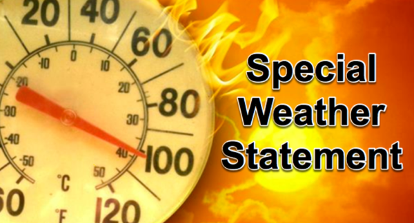
Stoddard County, MO - The National Weather Service in Paducah, KY has issued a Special Weather Statement for Stoddard County, Missouri.
..HEAT INDEX VALUES 100 TO 105 TODAY...
The combination of high temperatures in the middle 90s and high humidity will result in peak heat index readings from 100 to 105 this afternoon. The heat will intensify by Thursday with highs in the middle to upper 90s and peak heat index values in excess of 105. Some relief from the oppressive heat is expected by Friday and into the weekend.
Exercise caution if you must be outside for an extended period of time. If you find that you're becoming overheated, take a break in air conditioning and drink plenty of water. The heat affects us all differently, so listen to the warning signs your body may be trying to send.
Stoddard County, MO - The National Weather Service in Paducah, KY has issued a Special Weather Statement for Stoddard County, Missouri.
Description
...HEAT INDEX VALUES FROM 100 TO 105 DEGREES THIS AFTERNOON...
Temperatures will soar into the 90s by midday and into the afternoon hours. With elevated humidity levels in place, this will result in afternoon heat index values from 100 to 105.
Take it easy if you must be outside today. Young children and pets should never be left unattended in vehicles under any circumstances.

Stoddard County, MO - The National Weather Service in Paducah, KY has issued a Lake Wind Advisory until 7 p.m. this evening. The Wind Advisory has been cancelled.
Affected Area
Portions of southeast Missouri, western Kentucky and southern Illinois
Description
...LAKE WIND ADVISORY IN EFFECT UNTIL 7 PM CDT THIS EVENING... ...WIND ADVISORY IS CANCELLED...
WHAT...Southwest winds becoming northwest 10 to 20 mph with gusts of 30 to 35 mph.
WHERE...Portions of southeast Missouri, western Kentucky and southern Illinois.
WHEN...Until 7 PM CDT this evening.
IMPACTS...Strong winds and rough waves on area lakes will create hazardous conditions for small craft.
PRECAUTIONARY/PREPAREDNESS ACTIONS...
Boaters on area lakes should use extra caution since strong winds and rough waves can overturn small craft.

Stoddard County, MO - The National Weather Service in Paducah, KY has issued at Flash Flood Watch.
Description
...FLASH FLOOD WATCH REMAINS IN EFFECT FROM 1 PM CDT THIS AFTERNOON THROUGH THURSDAY EVENING...
The Flash Flood Watch continues for
Portions of southern Illinois...southwest Indiana...western Kentucky and southeast Missouri, including the following areas, in southern Illinois, Alexander, Edwards, Franklin, Gallatin, Hamilton, Hardin, Jackson, Jefferson, Johnson, Massac, Perry IL, Pope, Pulaski, Saline, Union, Wabash, Wayne IL, White and Williamson. In southwest Indiana, Gibson, Pike, Posey, Spencer, Vanderburgh and Warrick. In western Kentucky, Ballard, Carlisle, Crittenden, Daviess, Henderson, Livingston, McCracken, McLean, Union KY and Webster. In southeast Missouri, Bollinger, Butler, Cape Girardeau, Carter, Mississippi, New Madrid, Perry MO, Ripley, Scott, Stoddard and Wayne MO.
From 1 PM CDT this afternoon through Thursday evening
There will be the potential for several rounds of moderate to heavy rainfall this afternoon through Thursday evening. Rainfall totals of 2 to 4 inches will be possible. Locally higher amounts cannot be ruled out. This watch is generally in effect for locations north of a line extending from Doniphan, Missouri to Paducah, Kentucky to Calhoun, Kentucky.
In addition to the flash flood potential of urban and rural areas, main stem rivers may also be affected out in time.
PRECAUTIONARY/PREPAREDNESS ACTIONS...
Do not attempt to drive across water covered roads. If you come upon a flooded road, turn around and find an alternate route.

Stoddard County, MO - The National Weather Service in Paducah, KY has issued a Special Weather Statement for Stoddard County, MO.
...Southerly Wind Gusts near 35 MPH this Afternoon...
For residents and travelers across southeast Missouri and southern Illinois, look for occasional gusts near 35 mph. A few locations, especially in southern Illinois, may even see gusts to 40 mph.
These gusts may cause difficulty for those driving on west to east oriented roadways with high profile vehicles. Some loose objects left outdoors may be tossed around.
In addition, if you are traveling out on area lakes and rivers, be watchful for the development of choppy waves and whitecaps on the water. This may impact your ability to control your watercraft safely.
The greatest likelihood of seeing gusty winds in excess of 35 mph will be from Noon through 5 PM CDT today. The winds should gradually diminish toward sunset.

