ShowMe Weather
Tornado Watch Issued for Stoddard County until 5 p.m. Wednesday, May 8, 2024
May 08th 2024 by Dee Loflin
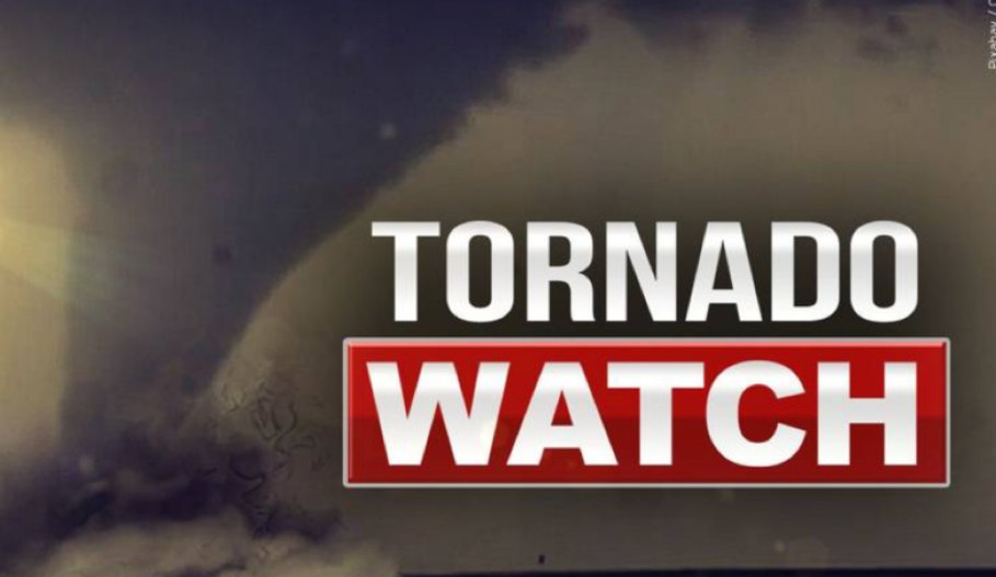
The National Weather Service in Paducah, KY has issued a Tornado Watch for Stoddard County until 5 p.m. Wednesday, March 8, 2024.
Description
THE NATIONAL WEATHER SERVICE HAS ISSUED TORNADO WATCH 204 IN EFFECT UNTIL 5 PM CDT THIS AFTERNOON FOR THE FOLLOWING AREAS IN ILLINOIS THIS WATCH INCLUDES 13 COUNTIES IN SOUTHERN ILLINOIS ALEXANDER FRANKLIN GALLATIN HARDIN JACKSON JOHNSON MASSAC PERRY POPE PULASKI SALINE UNION WILLIAMSON IN KENTUCKY THIS WATCH INCLUDES 13 COUNTIES IN WESTERN KENTUCKY BALLARD CALDWELL CALLOWAY CARLISLE CRITTENDEN FULTON GRAVES HICKMAN LIVINGSTON LYON MARSHALL MCCRACKEN TRIGG IN MISSOURI THIS WATCH INCLUDES 8 COUNTIES IN SOUTHEAST MISSOURI BOLLINGER CAPE GIRARDEAU MISSISSIPPI NEW MADRID PERRY SCOTT STODDARD WAYNE THIS INCLUDES THE CITIES OF BARDWELL, BENTON, BLOOMFIELD, CADIZ, CAIRO, CAPE GIRARDEAU, CARBONDALE, CHARLESTON, CLINTON, EDDYVILLE, ELIZABETHTOWN, GOLCONDA, HARRISBURG, HERRIN, HICKMAN, JACKSON, JONESBORO, MARBLE HILL, MARION, MAYFIELD, METROPOLIS, MOUND CITY, MURPHYSBORO, MURRAY, NEW MADRID, PADUCAH, PERRYVILLE, PIEDMONT, PINCKNEYVILLE, PRINCETON, SHAWNEETOWN, SIKESTON, SMITHLAND, VIENNA, WEST FRANKFORT, AND WICKLIFFE.
Last Updated on May 08th 2024 by Dee Loflin
https://showmetimes.com/Blogpost/vjk2/Tornado-Watch-Issued-for-Stoddard-County-until-5-pm-Wednesday-May-8-2024
Tornado Watch Issued for Stoddard County Until 2 a.m. Wednesday Morning
May 07th 2024 by Dee Loflin
The National Weather Service in Paducah, Kentucky has issued a Tornado Watch for Stoddard County, Missouri until 1 a.m. Wednesday morning.
Affected Area
Stoddard County
Description
THE NATIONAL WEATHER SERVICE HAS ISSUED TORNADO WATCH 198 IN EFFECT UNTIL 2 AM CDT /3 AM EDT/ WEDNESDAY FOR THE FOLLOWING AREAS IN ILLINOIS THIS WATCH INCLUDES 17 COUNTIES IN SOUTHEAST ILLINOIS EDWARDS IN SOUTHERN ILLINOIS ALEXANDER FRANKLIN GALLATIN HAMILTON HARDIN JEFFERSON JOHNSON MASSAC POPE PULASKI SALINE UNION WABASH WAYNE WHITE WILLIAMSON IN INDIANA THIS WATCH INCLUDES 6 COUNTIES IN SOUTHWEST INDIANA POSEY IN SOUTHWEST INDIANA GIBSON PIKE SPENCER VANDERBURGH WARRICK IN KENTUCKY THIS WATCH INCLUDES 22 COUNTIES IN WESTERN KENTUCKY BALLARD CALDWELL CALLOWAY CARLISLE CHRISTIAN CRITTENDEN DAVIESS FULTON GRAVES HENDERSON HICKMAN HOPKINS LIVINGSTON LYON MARSHALL MCCRACKEN MCLEAN MUHLENBERG TODD TRIGG UNION WEBSTER IN MISSOURI THIS WATCH INCLUDES 5 COUNTIES IN SOUTHEAST MISSOURI BUTLER MISSISSIPPI NEW MADRID SCOTT STODDARD THIS INCLUDES THE CITIES OF ALBION, BARDWELL, BENTON, BLOOMFIELD, BOONVILLE, CADIZ, CAIRO, CALHOUN, CARMI, CHARLESTON, CLINTON, DIXON, EDDYVILLE, ELIZABETHTOWN, ELKTON, EVANSVILLE, FAIRFIELD, FORT BRANCH, GOLCONDA, GRAYVILLE, GREENVILLE, HARRISBURG, HENDERSON, HERRIN, HICKMAN, HOPKINSVILLE, JONESBORO, MADISONVILLE, MARION, MAYFIELD, MCLEANSBORO, METROPOLIS, MORGANFIELD, MOUND CITY, MOUNT CARMEL, MOUNT VERNON, MURRAY, NEW MADRID, OWENSBORO, PADUCAH, PETERSBURG, POPLAR BLUFF, POSEYVILLE, PRINCETON, ROCKPORT, SHAWNEETOWN, SIKESTON, SMITHLAND, VIENNA, WEST FRANKFORT, WEST SALEM, AND WICKLIFFE.
Last Updated on May 07th 2024 by Dee Loflin
https://showmetimes.com/Blogpost/vjk0/Tornado-Watch-Issued-for-Stoddard-County-Until-2-am-Wednesday-Morning
Strong Gusty Winds - Special Weather Statement
April 03rd 2024 by Dee Loflin
National Weather Service in Paducah, Kentucky has issued a Special Weather Statement due to strong gusty winds.
Issued By
Paducah - KY, US, National Weather Service
Affected Area
Stoddard County
Description
...Strong Wind Gusts And Small Hail Possible Today... Due to a tight pressure gradient, expect strong gusty west- northwest winds today with gusts up to around 40 mph possible. Showers and isolated afternoon thunderstorms may mix down higher gusts at times. Small hail is possible today, even with non- thunderstorm showers. A cold air funnel or two may also occur. Secure any loose objects and be cautious when driving high profile and lightweight vehicles.
Last Updated on April 03rd 2024 by Dee Loflin
https://showmetimes.com/Blogpost/vjgh/Strong-Gusty-Winds--Special-Weather-Statement
Wind Advisory Issued for Stoddard County from 5 a.m. Monday - 5 a.m. Tuesday
March 24th 2024 by Dee Loflin
The National Weather Service in Paducah, Kentucky has issued a Wind Advisory for Stoddard County from 5 a.m. Monday to 5 a.m. Tuesday.
Affected Area
All of southern Illinois, southwest Indiana, western Kentucky, and southeast Missouri
Description
...WIND ADVISORY IN EFFECT FROM 5 AM CDT MONDAY TO 5 AM CDT TUESDAY... WHAT...South winds 20 to 30 mph with gusts up to 50 mph expected. WHERE...All of southern Illinois, southwest Indiana, western Kentucky, and southeast Missouri. WHEN...From 5 AM CDT /6 AM EDT/ Monday to 5 AM CDT /6 AM EDT/ Tuesday. IMPACTS...Gusty winds could blow around unsecured objects. Tree limbs could be blown down and a few power outages may result. ADDITIONAL DETAILS...Higher gusts are possible. Be sure to prepare for potential minor damages and travel difficulties due to high winds, especially for high profile and towing vehicles. In addition, area lakes will experience dangerously high wave conditions. PRECAUTIONARY/PREPAREDNESS ACTIONS... Use extra caution when driving, especially if operating a high profile vehicle. Secure outdoor objects.
Last Updated on March 24th 2024 by Dee Loflin
https://showmetimes.com/Blogpost/vjff/Wind-Advisory-Issued-for-Stoddard-County-from-5-am-Monday--5-am-Tuesday
Special Weather Statement Issued for Sunday and Monday Nights
March 17th 2024 by Dee Loflin
The National Weather Service in Paducah, Kentucky has issued a Special Weather Statement for Sunday and Monday nights.
Description
...Hard Freezes are Possible Tonight and Monday night... Very cold and dry surface high pressure will surge through the region bringing sub-freezing temperatures to the entire Quad State tonight and Monday night. Temperatures may drop into the middle 20s resulting in a hard freeze over the northern half of the region tonight, especially over southern Illinois. Temperatures Monday night are expected to drop into the middle and upper 20s throughout the Quad State, potentially leading to another hard freeze. Although the growing season has not officially started, some tender vegetation could be impacted by these cold temperatures. Please take necessary actions to protect any tender vegetation the next two nights.
Last Updated on March 17th 2024 by Dee Loflin
https://showmetimes.com/Blogpost/vjes/Special-Weather-Statement-Issued-for-Sunday-and-Monday-Nights
Tornado Watch Issued for Stoddard County Until 12 a.m.
March 14th 2024 by Dee Loflin
The National Weather Service in Paducah, KY has issued a Tornado Watch for Stoddard County, Missouri until 12 a.m.
Description
THE NATIONAL WEATHER SERVICE HAS ISSUED TORNADO WATCH 47 IN EFFECT UNTIL MIDNIGHT CDT /1 AM EDT/ TONIGHT FOR THE FOLLOWING AREAS IN ILLINOIS THIS WATCH INCLUDES 12 COUNTIES IN SOUTHERN ILLINOIS ALEXANDER GALLATIN HAMILTON HARDIN JOHNSON MASSAC POPE PULASKI SALINE UNION WHITE WILLIAMSON IN INDIANA THIS WATCH INCLUDES 6 COUNTIES IN SOUTHWEST INDIANA POSEY IN SOUTHWEST INDIANA GIBSON PIKE SPENCER VANDERBURGH WARRICK IN KENTUCKY THIS WATCH INCLUDES 22 COUNTIES IN WESTERN KENTUCKY BALLARD CALDWELL CALLOWAY CARLISLE CHRISTIAN CRITTENDEN DAVIESS FULTON GRAVES HENDERSON HICKMAN HOPKINS LIVINGSTON LYON MARSHALL MCCRACKEN MCLEAN MUHLENBERG TODD TRIGG UNION WEBSTER IN MISSOURI THIS WATCH INCLUDES 6 COUNTIES IN SOUTHEAST MISSOURI BUTLER MISSISSIPPI NEW MADRID RIPLEY SCOTT STODDARD THIS INCLUDES THE CITIES OF BARDWELL, BENTON, BLOOMFIELD, BOONVILLE, CADIZ, CAIRO, CALHOUN, CARMI, CHARLESTON, CLINTON, DIXON, DONIPHAN, EDDYVILLE, ELIZABETHTOWN, ELKTON, EVANSVILLE, FORT BRANCH, GOLCONDA, GREENVILLE, HARRISBURG, HENDERSON, HERRIN, HICKMAN, HOPKINSVILLE, JONESBORO, MADISONVILLE, MARION, MAYFIELD, MCLEANSBORO, METROPOLIS, MORGANFIELD, MOUND CITY, MURRAY, NEW MADRID, OWENSBORO, PADUCAH, PETERSBURG, POPLAR BLUFF, POSEYVILLE, PRINCETON, ROCKPORT, SHAWNEETOWN, SIKESTON, SMITHLAND, VIENNA, AND WICKLIFFE.
Last Updated on March 14th 2024 by Dee Loflin
https://showmetimes.com/Blogpost/vjeh/Tornado-Watch-Issued-for-Stoddard-County-Until-12-am
Wind Advisory Issued for Stoddard County, MO
February 27th 2024 by Dee Loflin
The National Weather Service in Paducah, Kentucky has issued a Wind Advisory for Stoddard County, MO.
Affected Area
All of southern Illinois, southwest Indiana, western Kentucky, and southeast Missouri
Description
...WIND ADVISORY REMAINS IN EFFECT FROM 7 AM CST /7 AM EST/ THIS MORNING TO 3 AM CST /3 AM EST/ WEDNESDAY... WHAT...Southwest winds 15 to 25 mph with gusts up to 40 mph expected. WHERE...All of southern Illinois, southwest Indiana, western Kentucky, and southeast Missouri. WHEN...From 7 AM CST /8 AM EST/ Tuesday to 3 AM CST /4 AM EST/ Wednesday. IMPACTS...Gusty winds could blow around unsecured objects. Tree limbs could be blown down and a few power outages may result. Automotive travel will be impacted, especially for high profile vehicles. Lakes will have high wave potential as well. ADDITIONAL DETAILS...Peak wind gusts will likely be in the afternoon or early evening for most of the area. PRECAUTIONARY/PREPAREDNESS ACTIONS... Use extra caution when driving, especially if operating a high profile vehicle. Secure outdoor objects.
Last Updated on February 27th 2024 by Dee Loflin
https://showmetimes.com/Blogpost/vjd7/Wind-Advisory-Issued-for-Stoddard-County-MO