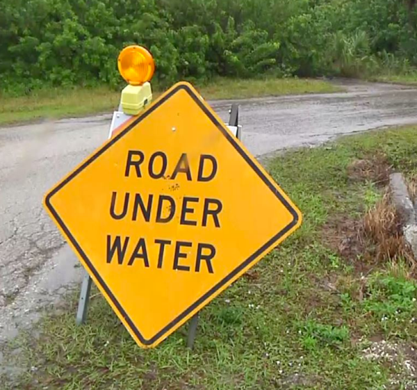
Flooded Roads in Southeast Missouri
Update May 2 at 11 a.m.
Missouri - The Missouri Department of Transportation has closed several state routes in Southeast Missouri due to the recent flooding.
In addition, motorists are encouraged to watch for flash flooding. This could cause water to quickly rise in areas that were previously safe. MoDOT crews will continually monitor state routes, but motorists are also urged to stop and turn around if they discover a roadway has high water.
Routes that are closed include:
Bollinger County:
Route H-north of Route 51
Route 91-Castor River Diversion Channel from Route T to Outer 91
Butler County:
Route 158-from Route 142 to US 67
Route 142-Route B in Ripley County to Route HH near Vastus in Butler County and from Route HH north to Route 158
Route N-CRD 243 to CRD 232
Route PP-at Cane Creek; CRD 449 to CRD 423/Route TT
Route W-CRD 542 to Route O; near Hilliard
Route 53-from Route UU to Route HH
Route WW-at Black River in Poplar Bluff, Mo.
Route HH-from Route H to CRD 329
Cape Girardeau County:
Route A-from Route F to CRD 233 and from CRD 255 to Route U
Route N-from Route U to Route NN and CRD 253 to CRD 254
Route F-at Route A
Route HH-from Route OO to end of state maintenance
Route U-from Route T to Route A
Kingshighway-Route 74 to Castor River Diversion Channel at Scott City
Route 74-Route 25 to CRD 214
Route 177-from CRD 651 to Country Club Drive in Cape Girardeau, Mo.
Carter County:
Business 60-at Van Buren; near James Street
Route 103-from Skyline Drive to Route Z
Route Z-from Route 103 to end of state maintenance
Route M-at Mill Creek and near Van Buren, Mo. at CRD 100
Route Y
Douglas County:
Route EE-at North Fork River; near Route AD
Route FF-at Hunter Creek; near Route 14
Route U-at Bryant Creek; south of Olathia
Route Y-at Cowskin Creek; approximately 3.5 miles after Route 76
Route 14-from Route 95 at Gentryville to Route AC
Route C-between CRD C-128 to just past the Wright/Douglas County line
Route W-near Route 95 at Vanzant to Route AH
Route AB-at Vera Cruz Access
Route AP-from Route 181 in Douglas County to Route 14 in Howell County
Dunklin County:
Route UU-from Route NN to CRD 711/end of state maintenance
Route DD-west of Route 53; from CRD 213 to CRD 203
Howell County:
Route 142-Route E to Route FF
Route UU-from Route 63 to east of CRD 2150
Route U-from Route UU to Route N
Route 63-from West Plains to south of Willow Springs, Mo.
Route N-from Route 17 to US 63
Route CC-from Dora, Mo. in Ozark County to Route AD in Howell County
Route AP-from Route 181 in Douglas County to Route 14 in Howell County
Route Z-from Route P to Route 76
Iron County:
Route C-east of Route 49 to west of CRD 424 in Madison County
Route D
Route F-at Crane Pond Creek
Route 143-Route 34 in Wayne County to Route 49 in Iron County
Madison County:
Route C-east of Route 49 in Iron County to west of CRD 424 in Madison County
Route V-CRD 243 to Route F
Oregon County:
Route 142-from CRD 243 to CRD 280; west of Calm/Route UU
Route M-south of Elliot Ford; between CRD 347 and CRD 349 and at Route DD at Rover
Ozark County:
Route 181-from Route H at Crossroads to Route N
Route 95-at Bryant Creek; between CRD 164 and CRD 156 and at Spring Creek; between CRD 136 and CRD 138
Route T-between CRD 518 and CRD 527
Route H-from CRD 352 to CRD 346
Route 160-at Route 95, Lutie, Mo. and at Norfolk Lake at Tecumseh
Route JJ-from CRD 920 to CRD 916 at Thornfield, Mo.
Route CC-from Dora, Mo. in Ozark County to Route AD in Howell County
Route J-Lick Creek; north of Howards Ridge
Route PP-North Fork River; near Route 160
Route EE-from Route O to end of state maintenance
Route N-near CRD 142 to the Ozark/Douglas County line
Route O-from Route 101 at Bakersfield to end of state maintenance
Route V-from Route O to US 160
Perry County:
Route E-from CRD 534 to CRD 322
Route AA-between CRD 508/510 and CRD 522
Route A-from Wittenberg to CRD 448
Route B-from Route K to CRD 502
Route C-at Menfro
Reynolds County:
Route 106-from west of Ellington in Reynolds County to near Current River in Shannon County (east of Route H)
Route F-at Logan Creek
Route K-east of Route O to west of CRD 440
Route B-CRD 786 to CRD 785 and CRD 758
Route HH-from Route RA in Reynolds County to Tacketts Pocket near Piedmont in Wayne County
Ripley County:
Route 142-at Doniphan, Mo. and Route B in Ripley County to Route HH near Vastus in Butler County
Route 21-in Doniphan, Mo.
Route A-near 21S-3 to CRD A-7
Route Y-from Pumpkin Patch Road to CRD Y-3
Route 160-at Current River near Doniphan, Mo.
Scott County:
Route E-at Commerce
Shannon County:
Route KK-Piatt Road to Route K at Akers
Route W
Route NN
Route F
Route 106-near Current River (east of Route H) to west of Ellington in Reynolds County and from Alley Spring to Route E (due to slide)
Route TT-Low Water Crossing located east of TT-683
Route 99-at Spring Creek; north of Route MM
Route M-from Route 60 to end of state maintenance
Ste. Genevieve County:
Route 32-from Gisi Road to Siebert Road
Route J-from Route 61 to Buehler Road
Route 61-from Route H to Route M
Stoddard County:
Route M-at Leora; near Route K
Route T-from CRD 404 in Stoddard County to the Wayne/Butler County line
Texas County:
Route 32-from Hillcrest Road to Mason Drive
Route EE-from Route 181 to Route AD
Wayne County:
Route C-CRD 224A to Route 34
Route 143-Route 34 in Wayne County to Route 49 in Iron County
Route FF-CRD 378 to CRD 380
Route KK-south of CRD 456
Route 34-at St. Francis River Bridge; from Route 143 to CRD 310 (west of US 67)
Business 67-from Route D to US 67; near Greenville, Mo.
Route 49-from Mill Spring, Mo. to CRD 440
Route HH-from Route RA in Reynolds County to Tacketts Pocket near Piedmont in Wayne County
Route D-at East Fork Lost Creek
Route T-from CRD 404 in Stoddard County to the Wayne/Butler County line
Wright County:
Route AB-Wolf Creek; near Adamson Road
Route E-Gasconade River; from Robinette Drive to north of Broyles Road
Route Z-Elk Creek-between Emmerson Road and Clayton Road
Route C-between CRD C-128 to just past the Wright/Douglas County line
Motorists are encouraged to use extreme caution and plan alternate routes.
MoDOT also offers the following driving tips that can help avoid delays and unsafe conditions during rainy weather:
Turn on your headlights when windshield wipers are needed. It's the law.
Slow down, use caution, and don't use cruise control when driving in rain to avoid skidding and hydroplaning.
Leave plenty of following distance behind the vehicle in front of yours.
Never move or drive around barricades placed on roadways due to high water. Barricades are a warning designed to protect you from an unsafe condition. You can put yourself at serious risk if you proceed into a flooded section of road.
If a road is closed, find another route.
Do NOT drive into high water. Stop and turn around. Notify local police, the sheriff or the Missouri State Highway Patrol.
"Turn Around - Don't Drown" as highways become impassable
For more information, please contact MoDOT's Customer Service Center toll-free at 1-888-ASK-MODOT (1-888-275-6636)