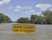
Local News

Ohio River Bridge to Close at Midnight Thursday
December 30th 2015 by Dee Loflin

Ohio River Bridge to Close at Midnight Thursday

Ballard County, Kentucky - The Kentucky Transportation will close the Ohio River “Cairo” Bridge and US 51 South of Wickliffe near the Ballard-Carlisle County line at midnight on Thursday, December 31, 2015.

According to Kentucky Transportation Cabinet District #1 they are required to close US 51 at the 6-mile marker between Wickliffe and the bridge at a little over 55 feet, thus cutting off access to the bridge.

There are about 5,000 plus cars and trucks that cross the bridge each day.  Drivers are advised to plan ahead and consider alternate routes of travel.


Last Updated on December 30th 2015 by Dee Loflin


Updated Road Closures Due to High Water
December 30th 2015 by Dee Loflin
Updated Road Closures Due to High Water

Missouri - Flooded Roadways in Southeast Missouri as of 10:00 a.m. Wednesday, December 30, 2015.

Update 10 am

Flooded Roadways Southeast MO


Bollinger County

  • Route H – from CR 702 to Route 51

Butler County

  • Route 158 – from Route 67 to Route 142
  • Route 142 – from Route EE to CR 353
  • Route N – from CR 243 to CR 231
  • Route 53 – from Route HH to Route 51
  • Route MM – from CR 355 to end of state maintenance

Cape Girardeau County

  • South Kingshighway in Cape – from Route 74 to Diversion Channel
  • Route 74 – from Route 25 to Diversion Channel
  • Route U – from Route A to CR 391
  • Route 177 – from Cape Rock to CR 640
  • Route A – over Hubble Creek
  • Route 25 – from Route 74 to Blomeyer
  • Route N/U/T junction
  • Ramp I-55 SB to MO 74
  • Route 61 – right lane closed to Route 74

Carter County

  • Route M – over Mill Creek
  • Route Z – near CR 206
  • Route Z – Skyline Drive to end of state maintenance

Douglas County

  • Route Y – over Cowskin Creek
  • Route FF- over Hunter Creek
  • Route U – over Bryant Creek
  • Route EE – over North Fork River

 Dunklin County

  • Route DD – from Route 53 to CR 228
  • Route ZZ – from CR 721 to end of state maintenance
  • Route F – from Route AC to Arkansas line

 Howell County

  • Route 142 – from 17 to CR 9330

Iron County

  • Route F – from CR 164 to CR 165 (Crane Pond Creek)

Madison County

  • Route V – from Rt F to CR 243
  • Route 162 – from CR 439 to end of state maintenance

New Madrid

  • Route V – from CR 702 to CR 708
  • Route 77 – from Route A to the Ferry
  • Route 80 – from Levee Rd to end of state maintenance

Oregon County

  • Route 142 – over the Eleven Point River

Ozark County

  • Route 95 – over Bryant Creek
  • Route 95 – from Route N to CR 167
  • Route H – over North Fork River
  • Route T – from CR 527 to CR 512


Perry County

  • Route E – from CR 322 to CR 354
  • Route A – at CR 460
  • Route C – from CR 352 to CR 354
  • Route M – from CR 924 to Route H
  • Route 61 – from CR 502 to CR 506
  • Route 51 – Chester bridge
  • Route U – from Route 61 to end of state maintenance

Reynolds County

  • Route F – over Logan Creek
  • Route CC – From CR 464 to Wayne County line


Ripley County

  • Route H – from CR H-8 to Route KK
  • Route H – from Route KK to CR H-9
  • Route 142 – from Route 67 to Naylor

Scott County

  • Route E – from CR 342 to Washington Street

Shannon County

  • Route KK – over Gladder Creek
  • Route H – over Rocky Creek
  • Route NN – over Rocky Creek
  • Route HH – over Carr Creek

Ste. Genevieve County

  • Route J – from Buehler Road to Route 61
  • Route 61 – from Route M to Route H

Stoddard County

  • Route D – from CR 725 to CR 751 

Texas County

  • Route BB – over Big Piney River
  • Route U – from Route HH to Route 137

Wayne County                                                              

  • Route KK – south of CR 456
  • Route FF – from CR 380 to Route 67
  • Route C – over Bear Creek

Wright County

  • Route Z – over Elk Creek
  • Route AB – over Wolf Creek
  • Route E – from Kempt Road to Dake Road
  • Route E – from Day Road to Wylie Road

For more information, please contact MoDOT's Customer Service Center toll-free at 1-888-ASK-MODOT (1-888-275-6636) or visit the Traveler Information Map at:

http://traveler.modot.org/map/?district=SOUTHEAST


Last Updated on December 30th 2015 by Dee Loflin


Flooded Roadways in Southeast Missouri
December 29th 2015 by Dee Loflin
Flooded Roadways in Southeast Missouri

Southeast Missouri - Flooded Roadways Southeast MO


Bollinger County

  • Route H – from CR 702 to Route 51

Butler County

  • Route 158 – from Route 67 to Route 142
  • Route 142 – from Route EE to CR 353
  • Route 142 – Route 67 to Naylor City Limits
  • Route N – from CR 243 to CR 231
  • Route B – from CR 542 to Route O

Cape Girardeau County

  • Route A – from Route U to CR 255
  • South Kingshighway in Cape – from Route 74 to Diversion Channel
  • Route 74 – from Route 25 to Diversion Channel

Carter County

  • Route M – over Mill Creek
  • Route Z – near CR 206

Douglas County

  • Route Y – over Cowskin Creek
  • Route FF- over Hunter Creek
  • Route U – over Bryant Creek
  • Route EE – over North Fork River


Dunklin County

  • Route DD – from Route 53 to CR 228
  • Route ZZ – from CR 721 to end of state maintenance


Howell County

  • Route Y – from Route 60 to the Texas County line
  • Route U – from Route 60 to Route N
  • Route K – from Route KK to Route MM
  • Route 142 – over Bennetts River


Iron County

  • Route F – from CR 164 to CR 165 (Crane Pond Creek)


Madison County

  • Route V – from CR 238 to CR 243
  • Route C – from Route V to CR 238
  • Route C – From Route N to the Iron County line
  • Route O – from Route E to End of State Maintenance

New Madrid

  • Route V – from CR 702 to CR 708

Oregon County

  • Route K – over Whites Creek
  • Route 142 – over the Eleven Point River


Ozark County

  • Route 95 – over Bryant Creek
  • Route 95 – from Route N to CR 167
  • Route 181 – over Bryant Creek
  • Route H – over North Fork River
  • Route T – from CR 527 to CR 512


Perry County

  • Route E – from CR 322 to CR 354
  • Route A – at CR 460
  • Route C – from CR 352 to CR 354

Reynolds County

  • Route F – over Logan Creek
  • Route 106 – near Logan Creek
  • Route CC – From CR 465 to Wayne County line


Ripley County

  • Route K – over South Prong Beaverdam Creek
  • Route K – over Little Black River
  • Route NN – over North Prong Little Black River
  • Route H – from CR H-8 to Route KK
  • Route H – from Route KK to CR H-9

Scott County

  • Route E – from CR 342 to Washington Street

Shannon County

  • Route NN – over Rocky Creek
  • Route MM – from CR 651 to CR 99
  • Route T – over Spring Creek
  • Route N – over Spring Valley Creek


Ste. Genevieve County

  • Route C – from Lawrencton Cut Off Road to Sprott Road
  • Route 61 – from Route M to Route H


St. Francois County

  • Route 221 – over the St. Francis River
  • Route F – from Old Jackson Road to Wolf Creek Bridge


Stoddard County

  • Route K from Route M to Route BB


Texas County

  • Route BB – over Big Piney River
  • Route U – from Route HH to Route 137
  • Route VV – from Laner Road to Shepard Drive

Last Updated on December 29th 2015 by Dee Loflin


Ramp 25 South to US 60 Reduced for Pavement Repairs
December 17th 2015 by Dee Loflin
Ramp 25 South to US 60 Reduced for Pavement Repairs
Ramp 25 South to US 60 West in Stoddard County Reduced for Pavement Repairs
 
Ramp 25 South to U.S. 60 Westbound in Stoddard County will be reduced to one lane as Missouri Department of Transportation crews perform pavement repairs.

This ramp is located from Route 25 South to U.S. 60 Westbound.

Weather permitting, work will take place Thursday, Dec. 17 and Friday, Dec. 18 from 7 a.m. to 5 p.m. daily.

Last Updated on December 17th 2015 by Dee Loflin


Route K in Stoddard County Reduced for Tree Trimming
December 14th 2015 by Dee Loflin
Route K in Stoddard County Reduced for Tree Trimming
 

Route K in Stoddard County will be reduced to one lane as Missouri Department of Transportation crews trim trees along the roadway.

This section of roadway is located from Route 25 to Route M.

Work will take place, weather permitting Tuesday, Dec. 15 through Friday, Dec. 18 from 7:30 a.m. to 3 p.m. daily.

The work zone will be marked with signs.  Motorists are urged to use extreme caution while traveling near the area.

For additional information, contact MoDOT’s Customer Service Center toll-free at 1-888-ASK-MODOT (1-888-275-6636) or visit www.modot.org/southeast.

Last Updated on December 14th 2015 by Dee Loflin


Subscribe to "Local News"

ShowMe Gold Sponsors