Local News

Don't Become a New Year's Eve Statistic
December 31st 2013 by Dee Loflin
Don't Become a New Year's Eve Statistic
Submitted by
Dee Loflin, SMT Manager/Editor

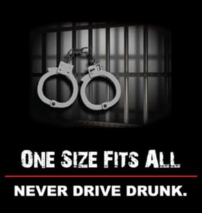
Missouri -
There are no excuses for driving drunk. The consequences are known: fines, jail time or even death.

As you prepare for your New Year's Eve, top your list with a designated driver. The Missouri Department of Transportation wants to remind those who plan to drink alcohol to designate a sober driver or call a cab.

Statewide, law enforcement is on the lookout for impaired drivers.  Many municipalities will be shoring up their patrols with a focus on intoxicated drivers.

"Don't become a New Year's Eve statistic," said Dave Nichols, MoDOT director. "Last year, 12 people were killed and 63 were seriously injured in Missouri traffic crashes over the New Year's holiday."

Nichols noted that four of the fatalities and 11 of the serious injuries involved a substance-impaired driver.

"We are making a special effort to reach motorists with reminders to plan ahead if they're going to drink tonight," Nichols said. "This is a time of celebration, but it's also a time to use forethought and common sense."

Light snow is also forecasted for many parts of the state over the next 24 hours, adding to the need for caution when operating a vehicle.

Last Updated on December 31st 2013 by Dee Loflin


More from ShowMe Times:
SANTA Has Been Spotted!
December 23rd 2013 by Dee Loflin
SANTA Has Been Spotted!

Written by
Dee Loflin, SMT Manager/Editor

Dexter, Missouri – Santa has been spotted by NORAD!  Did you know that children all over the United States can track Santa Clause?  The North American Aerospace Defense Command  (NORAD) is set to start tracking St. Nick’s travels tonight.

You can head over to NoradSanta.org to see the countdown clock ticking down to that final hour.  NORAD has been tracking Santa via its high-tech instruments since 1955 with its festive annual program designed to show children how the red-suited, jolly fellow makes his way to chimneys all over the world. 

Children can explore the North Pole and see Santa’s Village.  There are games, movies and music to keep the children entertained for hours as they wait for Santa.

How did all this get started?  Go to the Secret Santa Files and learn how Sears Roebuck & Co. misprinted a telephone number for children to call Santa.  The phone number put kids through to the CONAD Commander-in-Chief’s operations “hotline”.  OOPS!  Not to disappoint all the children, the Director had his staff check the radar for Santa and so it became tradition.  CONAD was later renamed to NORAD. 

Satellites help track Rudolph’s red nose with no problem.  The satellites are only 22,300 miles above the earth each with infrared sensors searching for heat. Rudolph's red nose sure puts off some heat with that GLOW!

NORAD intelligence even posts videos almost every hour on Christmas Eve of Santa making his way around the world.  There is even specific technical data about Santa’s sleight.  Did you know it is 75 candy canes long and 40 candy canes wide? Or that the maximum speed is faster than starlight?  Or that the fuel consists of hay, oats and carrots to keep his nine reindeer in tiptop shape?  There is so much to learn at NoradSanta.org.  Go check it out this holiday season.

HO! HO! HO! Merry Christmas to all!


Last Updated on December 23rd 2013 by Dee Loflin


More from ShowMe Times:
Flash Flood Warning for Stoddard County
December 21st 2013 by Dee Loflin
Flash Flood Warning for Stoddard County
Submitted by
Dee Loflin, SMT Manager/Editor

Stoddard County, Missouri - Updated Dec 21, 2013, 11:45am CST

THE NATIONAL WEATHER SERVICE IN PADUCAH HAS ISSUED A  FLASH FLOOD WARNING FOR... BOLLINGER COUNTY IN SOUTHEAST MISSOURI... BUTLER COUNTY IN SOUTHEAST MISSOURI... CAPE GIRARDEAU COUNTY IN SOUTHEAST MISSOURI... CARTER COUNTY IN SOUTHEAST MISSOURI... MISSISSIPPI COUNTY IN SOUTHEAST MISSOURI... NEW MADRID COUNTY IN SOUTHEAST MISSOURI... PERRY COUNTY IN SOUTHEAST MISSOURI... RIPLEY COUNTY IN SOUTHEAST MISSOURI... SCOTT COUNTY IN SOUTHEAST MISSOURI... STODDARD COUNTY IN SOUTHEAST MISSOURI... WAYNE COUNTY IN SOUTHEAST MISSOURI...

* UNTIL 100 PM CST.

* AT 656 AM CST... HEAVY RAINFALL CONTINUED TO TRACK ACROSS MUCH OF SOUTHEAST MISSOURI REPORTS OF CREEKS, DITCHES AND SMALL RIVERS APPROACHING BANKFULL OR OUT OF BANKS. SEVERAL REPORTS OF 3 TO NEARLY 4 INCHES OF RAINFALL ACCUMULATIONS HAVE BEEN RECEIVED.

* LOCATIONS IN THE WARNED AREA INCLUDE... GREENVILLE... SAM A. BAKER STATE PARK... ADVANCE... PIEDMONT... MARBLE HILL... ORAN... BOLLINGER MILL STATE HISTORIC SITE... CHAFFEE... VAN BUREN... BENTON... JACKSON... SCOTT CITY... CAPE GIRARDEAU... TRAIL OF TEARS STATE PARK... PERRYVILLE... SHOOK... LODI... GRASSY... CASCADE AND BELL CITY.

PRECAUTIONARY/PREPAREDNESS ACTIONS...

ADDITIONAL RAINFALL AMOUNTS OF 2 TO 3 INCHES ARE POSSIBLE IN THE WARNED AREA THROUGH THE MORNING HOURS.

EXCESSIVE RUNOFF FROM HEAVY RAINFALL WILL CAUSE FLOODING OF SMALL CREEKS AND STREAMS... HIGHWAYS AND UNDERPASSES. ADDITIONALLY... COUNTRY ROADS AND FARMLANDS ALONG THE BANKS OF CREEKS... STREAMS AND OTHER LOW LYING AREAS ARE SUBJECT TO FLOODING.

DO NOT DRIVE YOUR VEHICLE INTO AREAS WHERE THE WATER COVERS THE ROADWAY. THE WATER DEPTH MAY BE TOO GREAT TO ALLOW YOUR CAR TO CROSS SAFELY. MOVE TO HIGHER GROUND.

MOST FLOOD DEATHS OCCUR IN AUTOMOBILES. NEVER DRIVE YOUR VEHICLE INTO AREAS WHERE THE WATER COVERS THE ROADWAY. FLOOD WATERS ARE USUALLY DEEPER THAN THEY APPEAR. JUST ONE FOOT OF FLOWING WATER IS POWERFUL ENOUGH TO SWEEP VEHICLES OFF THE ROAD. WHEN ENCOUNTERING FLOODED ROADS MAKE THE SMART CHOICE... TURN AROUND... DONT DROWN.


Last Updated on December 21st 2013 by Dee Loflin


More from ShowMe Times:
Severe Weather for Weekend
December 19th 2013 by Dee Loflin
Severe Weather for Weekend
Submitted by
Dee Loflin, SMT Manager/Editor
Stoddard County, Missouri - 

Flood Watch for Stoddard, MO

From 6:00 PM CST, Fri., Dec 20, 2013 until 6:00 AM CST, Sun., Dec 22, 2013

Other affected areas: 
Jefferson, IL;  Wayne, IL;  Edwards, IL;  Wabash, IL;  Perry, IL;  Franklin, IL;  Hamilton, IL;  White, IL;  Jackson, IL;  Williamson, IL;  Saline, IL;  Gallatin, IL;  Union, IL;  Johnson, IL;  Pope, IL;  Hardin, IL;  Alexander, IL;  Pulaski, IL;  Massac, IL;  Gibson, IN;  Pike, IN;  Posey, IN;  Vanderburgh, IN;  Warrick, IN;  Spencer, IN;  Fulton, KY;  Hickman, KY;  Carlisle, KY;  Ballard, KY;  McCracken, KY;  Graves, KY;  Livingston, KY;  Marshall, KY;  Calloway, KY;  Crittenden, KY;  Lyon, KY;  Trigg, KY;  Caldwell, KY;  Union, KY;  Webster, KY;  Hopkins, KY;  Christian, KY;  Henderson, KY;  Daviess, KY;  McLean, KY;  Muhlenberg, KY;  Todd, KY;  Perry, MO;  Bollinger, MO;  Cape Girardeau, MO;  Wayne, MO;  Carter, MO;  Ripley, MO;  Butler, MO;  Stoddard, MO;  Scott, MO;  Mississippi, MO;  New Madrid, MO

... FLOOD WATCH IN EFFECT FROM FRIDAY EVENING THROUGH LATE SATURDAY NIGHT...

THE NATIONAL WEATHER SERVICE IN PADUCAH HAS ISSUED A

* FLOOD WATCH FOR ALL OF SOUTHEAST MISSOURI... SOUTHERN ILLINOIS... SOUTHWEST INDIANA AND WESTERN KENTUCKY.

* FROM FRIDAY EVENING THROUGH LATE SATURDAY NIGHT.

* 3 TO 5 INCHES OF RAINFALL IS FORECAST FROM FRIDAY THROUGH SATURDAY NIGHT WITH THE HEAVIEST RAINFALL EXPECTED FROM LATE FRIDAY NIGHT THROUGH ABOUT MIDNIGHT SATURDAY NIGHT.

* GROUND CONDITIONS REMAIN SATURATED FROM RECENT SNOW MELT AND PAST PRECIPITATION EVENTS. HEAVY RAINFALL WILL RESULT IN CREEKS AND SMALL STREAMS COMING OUT OF THEIR BANKS. ROADS THAT TYPICALLY FLOOD... WILL DO SO DURING THIS EVENT. THE HEAVY RAIN ACROSS THE OHIO VALLEY REGION WILL LIKELY HAVE SOME INFLUENCE ON LARGER RIVERS AND THEIR LEVELS OVER THE NEXT WEEK OR SO

  ...HEAVY RAIN LIKELY LATE FRIDAY THROUGH EARLY SUNDAY...FLOODING POSSIBLE...

RECENT PRECIPITATION AND SNOW MELT WILL COMBINE WITH EXPECTED RAINFALL LATE THIS WEEK...TO INCREASE THE CHANCE OF FLOODING. MODEL PROJECTIONS SUGGEST GENERALLY 3 TO 4 INCHES OF RAIN WILL FALL STARTING THURSDAY NIGHT...CONTINUING THROUGH EARLY SUNDAY ACROSS MOST OF SOUTHEASTERN MISSOURI...SOUTHERN ILLINOIS...SOUTHWESTERN INDIANA AND WESTERN KENTUCKY. WET SOILS WILL INCREASE THE CHANCE FOR FLASH FLOODING. DITCHES...CREEKS AND SMALLER RIVERS MAY FILL QUICKLY AND OVERFLOW. ROADS MAY BECOME WATER COVERED QUICKLY...ESPECIALLY THOSE TYPICALLY AFFECTED BY FLOOD WATERS.

LONGER RANGE MODEL OUTPUT SUGGESTS MINOR RIVER FLOODING MAY BE POSSIBLE DURING CHRISTMAS WEEK. WITH RESPECT TO THE LARGER RIVERS...ONLY LOW LAND RIVER FLOODING IS EXPECTED THAT MAY IMPACT AGRICULTURAL LAND AND A FEW ROADS CLOSEST TO THE RIVER.

WE WILL CONTINUE TO MONITOR THE LATEST FORECAST DATA...AND MAKE NECESSARY ADJUSTMENTS TO WHERE THE HEAVIEST RAIN IS EXPECTED TO OCCUR.

Last Updated on December 19th 2013 by Dee Loflin


More from ShowMe Times:
Three Rivers Breaks Ground on Humanities and Social Sciences Building
December 19th 2013 by Dee Loflin
Three Rivers Breaks Ground on Humanities and Social Sciences Building

Submitted by Jill Temples

SMT Writer


Three Rivers College marked the continuation of a series of expansions and renovations across its 15-county service area with a groundbreaking ceremony for its Humanities and Social Sciences classroom building, held on December 18 on the college’s Poplar Bluff campus.

“We’re celebrating the continuation of the transformation of our Poplar Bluff Campus and the positioning of our institution to meet the demands we face as the primary job creator for Southeast Missouri,” said Dr. Devin Stephenson, President of Three Rivers College. “The building will also increase the collegiate feel of our campus, especially when combined with the newly renovated Academic Resource Commons. We want to make our institution a place that students are proud of when they walk on campus.”

Speakers at the ceremony included Dr. Stephenson; Darren Garrison, Chair of the Three Rivers Board of Trustees; Steve Halter, President of the Greater Poplar Bluff Area Chamber of Commerce; Riley Bock, Chair of the Three Rivers Endowment Trust; and Emily Parks, Director of Development for Three Rivers College and Executive Director of the Three Rivers Endowment Trust.

“When I read about other towns in the Midwest that are successful, that are prospering, the key is always education,” said Halter. “Three Rivers is that key to success for Poplar Bluff. They are behind the economic engine that is driving through our city.”

The 40,000-square-foot classroom building, when completed, will include the college’s first lecture hall, 16 state-of-the-art classrooms, and three computer labs. In addition, the structure will also contain a  two-story FEMA-certified safe room capable of withstanding 200-mile-per-hour winds. The building will be located on the east side of the Poplar Bluff Campus by the Academic Resource Commons and the Westover Administration Building.

Construction is expected to cost $6.3 million and be completed in spring 2015. The project will be partially funded by a $2.6 million federal FEMA safe room grant, with the remainder provided through the fundraising efforts of the Three Rivers Endowment Trust and a bond issue.

During construction, parking by the Westover Building and the Academic Resources Commons will be limited, and the college will close the section of road between the Westover Building and the Bess Activity Center. The roadway leading from Three Rivers Boulevard to the Westover Building will become two-way for the duration of construction.

The Three Rivers Endowment Trust is a 501(c)(3) not-for-profit organization, designated by Three Rivers College to receive and manage gifts on behalf of the College. It acts as a trustee for donations to assure that gifts are distributed in the manner specified by the donor. To make a donation, contact Endowment Trust Executive Director Emily Parks at 573-840-9077, or Michelle Reynolds, development officer, at 573-472-6650. More information is also online at http://trcc.edu/development/endowment.php.

Three Rivers College is committed to contributing to the quality of life in Southeast Missouri with quality, affordable higher education opportunities and community services that support and encourage the economic, civic, and cultural vitality of the region. For more information about college and workforce programs and upcoming events, visit trcc.edu.


Last Updated on December 19th 2013 by Dee Loflin


More from ShowMe Times:
Subscribe to "Local News"

ShowMe Gold Sponsors