ShowMe Weather
Extreme Cold Safety Tips - Going to Get Cold in Stoddard County!
February 17th 2025 by Dee Loflin
Extreme Cold Safety
 General Information
- Minimize travel.
- Stay indoors during the worst part of the extreme cold.
- Keep a winter survival kit in your vehicle if you must travel.
- Check tire pressure, antifreeze levels, heater/defroster, etc.
- Learn how to shut off water valves for potential pipe bursts.
- Check on the elderly.
- Bring pets inside.
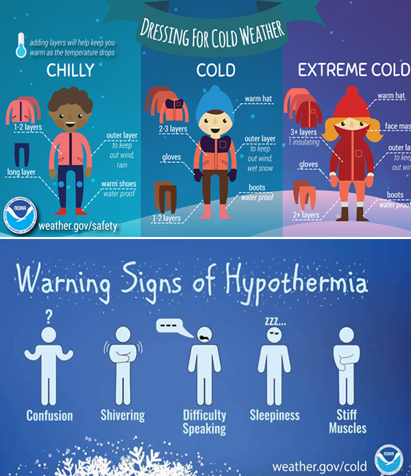
How Should I Dress?
- Wear layers of loose-fitting, lightweight, warm clothing, and a hat.
- Mittens, snug at the wrist, are better than gloves.
- Cover your mouth to protect your lungs from extreme cold.
- Try to stay dry and out of the wind.
Last Updated on February 17th 2025 by Dee Loflin
https://showmetimes.com/Blogpost/vl40/Extreme-Cold-Safety-Tips--Going-to-Get-Cold-in-Stoddard-County

