ShowMe Weather
Subscribe to "ShowMe Weather"

ShowMe Gold Sponsors

Winter Storm Warning Issued for Stoddard County
January 30th 2023 by Dee Loflin
Winter Storm Warning Issued for Stoddard County

The National Weather Service in Paducah, Kentucky has issued a Winter Storm Warning until 9 a.m. Tuesday, January 31, 2023.

Affected Area

Portions of southern Illinois and southeast Missouri

Description

...WINTER STORM WARNING IN EFFECT UNTIL 9 AM CST TUESDAY... WHAT...Heavy mixed precipitation. Sleet and snow accumulations of up to one inch and ice accumulations of less than one tenth of an inch. WHERE...Portions of southern Illinois and southeast Missouri. WHEN...Until 9 AM CST Tuesday. IMPACTS...Difficult travel conditions are likely as roadways turn icy. PRECAUTIONARY/PREPAREDNESS ACTIONS... If you must travel, keep an extra flashlight, food, and water in your vehicle in case of an emergency.

Last Updated on January 30th 2023 by Dee Loflin


More from ShowMe Times:
Winter Weather Advisory Issued for Stoddard County Until 9 a.m. Monday Morning
January 29th 2023 by Dee Loflin
Winter Weather Advisory Issued for Stoddard County Until 9 a.m. Monday Morning

The National Weather Service in Paducah, Kentucky has issued a Winter Weather Advisory for Stoddard County, Missouri until 9 a.m. Monday morning.

Affected Area

Portions of southern Illinois, southwest Indiana, western Kentucky, and southeast Missouri

Description

...WINTER WEATHER ADVISORY IN EFFECT FROM 6 PM THIS EVENING TO 9 AM CST MONDAY... WHAT...Freezing drizzle expected. Total ice accumulations of a light glaze up to one tenth of an inch. WHERE...Portions of southern Illinois, southwest Indiana, western Kentucky, and southeast Missouri. WHEN...From 6 PM this evening to 9 AM CST Monday. IMPACTS...Difficult travel conditions are possible, especially on bridges, overpasses, and sidewalks. The hazardous conditions could impact the Monday morning commute. ADDITIONAL DETAILS...Freezing drizzle will begin in the Ozark Foothills of southeast Missouri tonight, then spread eastward overnight, reaching the Ohio River during the predawn hours Monday morning. PRECAUTIONARY/PREPAREDNESS ACTIONS... Slow down and use caution while traveling.

Last Updated on January 29th 2023 by Dee Loflin


More from ShowMe Times:
National Weather Service Issued a Winter Weather Advisory
January 24th 2023 by Dee Loflin
National Weather Service Issued a Winter Weather Advisory

The National Weather Service has issued a Winter Weather Advisory for Stoddard County, Missouri.

Affected Area

In southeast Missouri, Stoddard and Scott counties, in southern Illinois, along and southeast of an Anna to Marion to Carmi line, and all of southwest Indiana

Description

...WINTER WEATHER ADVISORY REMAINS IN EFFECT FROM 6 PM THIS EVENING TO NOON CST WEDNESDAY... WHAT...Wet snow expected. Total snow accumulations of up to 3 inches. Winds gusting as high as 40 mph. WHERE... In southeast Missouri, Stoddard and Scott counties, in southern Illinois, along and southeast of an Anna to Marion to Carmi line, and all of southwest Indiana. WHEN...From 6 PM this evening to noon CST Wednesday. IMPACTS...Plan on slippery road conditions. The hazardous conditions could impact the morning commute.


Last Updated on January 24th 2023 by Dee Loflin


More from ShowMe Times:
Flood Advisory Issued for Stoddard County
January 18th 2023 by Dee Loflin
Flood Advisory Issued for Stoddard County

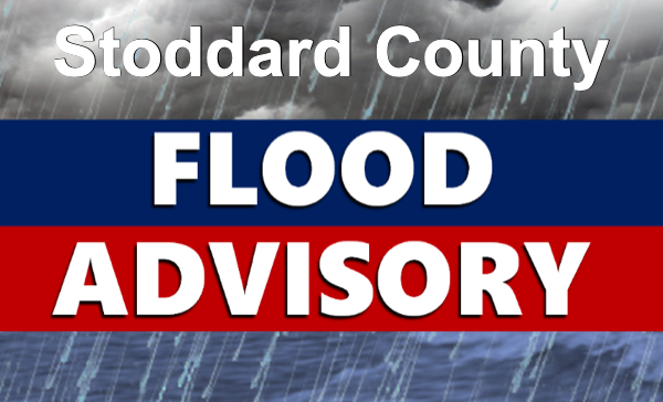
Stoddard County, MO - The National Weather Service in Paducah, KY has issued a Flood Advisory until 7:45 p.m. this evening.

Affected Area

A portion of southeast Missouri, including the following counties, Bollinger, Cape Girardeau, Scott, and Stoddard

Description

...FLOOD ADVISORY IN EFFECT UNTIL 745 PM CST THIS EVENING...

WHAT...Additional ongoing rainfall will be adding to what has already fallen, which will produce street and low land flooding issues.

WHERE...A portion of southeast Missouri, including the following counties, Bollinger, Cape Girardeau, Scott, and Stoddard.

WHEN...Until 745 PM CST.

IMPACTS...Minor flooding in low-lying and poor drainage areas.

ADDITIONAL DETAILS... - At 437 PM CST, Doppler radar indicated heavy rain due to thunderstorms. Minor flooding is already occurring in the advisory area. The public reported water starting to flood around Highway 177 in Cape Girardeau county, Missouri. - Some locations that will experience flooding include... Cape Girardeau, Sikeston, Jackson, Dexter, Scott City, Chaffee, Bernie, Bloomfield, Marble Hill, Advance, Oran, Miner, Benton, Bollinger Mill State Historic Site, Trail Of Tears State Park, Morehouse, Puxico, Morley, Kelso and Essex.


Last Updated on January 18th 2023 by Dee Loflin


More from ShowMe Times:
Flood Watch for Stoddard County
January 02nd 2023 by Dee Loflin
Flood Watch for Stoddard County

The National Weather Service in Paducah, Kentucky has issued a Flood Watch for Stoddard County.


Affected Area

Portions of western Kentucky and southeast Missouri, including the following counties, in western Kentucky, Ballard, Calloway, Carlisle, Fulton, Graves, Hickman, Marshall and McCracken. In southeast Missouri, Butler, Mississippi, New Madrid, Scott and Stoddard

Description

...FLOOD WATCH NOW IN EFFECT THROUGH TUESDAY MORNING... WHAT...Flooding caused by excessive rainfall continues to be possible. WHERE...Portions of western Kentucky and southeast Missouri, including the following counties, in western Kentucky, Ballard, Calloway, Carlisle, Fulton, Graves, Hickman, Marshall and McCracken. In southeast Missouri, Butler, Mississippi, New Madrid, Scott and Stoddard. WHEN...Through Tuesday morning. IMPACTS...Excessive runoff may result in flooding of rivers, creeks, streams, and other low-lying and flood-prone locations. Flooding may occur in poor drainage and urban areas. Low-water crossings may be flooded. Storm drains and ditches may become clogged with debris. ADDITIONAL DETAILS... - Broad rainfall amounts of one to two inches are expected, but areas that experience multiple rounds of thunderstorms or prolonged training of storms may see as much as 3 to 4 inches of rain.

More Information

.Rounds of heavy rain and thunderstorms will develop this evening and continue through Tuesday morning. Flash flooding, some potentially significant, is possible.

Last Updated on January 02nd 2023 by Dee Loflin


More from ShowMe Times:
Special Weather Statement issued for Stoddard County until 4 a.m.
December 25th 2022 by Dee Loflin
Special Weather Statement issued for Stoddard County until 4 a.m.

The National Weather Service in Paducah, Kentucky has issued a Special Weather Statement.  Possible snow accumulation until 4 a.m. 

Affected Area

Stoddard County

Description

...Accumulating Light Snow Expected Late Tonight and Monday... A clipper system will bring light snow accumulations late tonight through Monday. Total accumulations of less than an inch are expected across far southern portions of southeast Missouri and western Kentucky. While significant impacts are not expected, the light snow may cause some minor travel issues to develop ahead of the Monday morning commute. Stay tuned for updates to the forecast through Monday.

Weather provided by Bagby Wealth Management

Last Updated on December 25th 2022 by Dee Loflin


More from ShowMe Times:
Winter Storm Warning Issued for Stoddard County
December 22nd 2022 by Dee Loflin
Winter Storm Warning Issued for Stoddard County

The National Weather Service in Paducah, Kentucky has issued a WINTER STORM WARNING!

Description

...WINTER STORM WARNING IN EFFECT UNTIL 9 PM CST THIS EVENING... ...WIND CHILL WARNING REMAINS IN EFFECT FROM 6 PM THIS EVENING TO NOON CST FRIDAY... WHAT...For the Winter Storm Warning, heavy snow expected. Total snow accumulations of 2 to 4 inches. Winds gusting as high as 40 mph. For the Wind Chill Warning, dangerously cold wind chills expected. Wind chills as low as 30 below zero. WHERE...Portions of southern Illinois and southeast Missouri. WHEN...For the Winter Storm Warning, until 9 PM CST this evening. For the Wind Chill Warning, from 6 PM this evening to noon CST Friday. IMPACTS...Plan on slippery road conditions. Patchy blowing snow could significantly reduce visibility. The hazardous conditions could impact the morning or evening commute. The cold wind chills could cause frostbite on exposed skin in as little as 30 minutes. ADDITIONAL DETAILS...Isolated higher amounts of snow cannot be ruled out if heavier snow bands develop. PRECAUTIONARY/PREPAREDNESS ACTIONS... If you must travel, keep an extra flashlight, food, and water in your vehicle in case of an emergency. Avoid outside activities if possible. When outside, make sure you wear appropriate clothing, a hat, and gloves.

Last Updated on December 22nd 2022 by Dee Loflin


More from ShowMe Times: