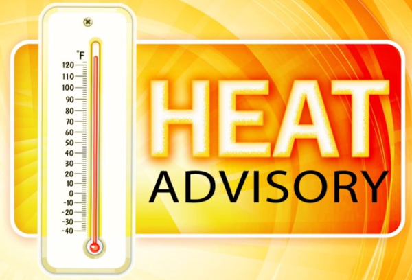
Stoddard County, MO - The National Weather Service in Paducah, KY has downgraded the Excessive Heat Warning to a HEAT ADVISORY from 8 p.m. Thursday until 8 p.m. Friday.
Affected Area
Portions of southeast Missouri, far western Kentucky and far southwest Illinois
Description
...HEAT ADVISORY IN EFFECT UNTIL 8 PM CDT FRIDAY... ...EXCESSIVE HEAT WARNING WILL EXPIRE AT 8 PM CDT THIS EVENING...
WHAT...Heat index values of 100 to 105 degrees expected Friday afternoon.
WHERE...Portions of southeast Missouri, far western Kentucky and far southwest Illinois.
WHEN...Until 8 PM CDT Friday.
IMPACTS...Hot temperatures and high humidity may cause heat illnesses to occur.
ADDITIONAL DETAILS...Isolated to scattered thunderstorms may bring pockets of relief from the heat.
PRECAUTIONARY/PREPAREDNESS ACTIONS...
Drink plenty of fluids, stay in an air-conditioned room, stay out of the sun, and check up on relatives and neighbors. Young children and pets should never be left unattended in vehicles under any circumstances.
Take extra precautions if you work or spend time outside. When possible reschedule strenuous activities to early morning or evening. Know the signs and symptoms of heat exhaustion and heat stroke. Wear lightweight and loose fitting clothing when possible. To reduce risk during outdoor work, the Occupational Safety and Health Administration recommends scheduling frequent rest breaks in shaded or air conditioned environments. Anyone overcome by heat should be moved to a cool and shaded location. Heat stroke is an emergency! Call 9 1 1.

Stoddard County, MO - The National Weather Service in Paducah, KY has extended the Excess Heat Warning until 8 p.m. Thursday evening.
Description
...EXCESSIVE HEAT WARNING REMAINS IN EFFECT UNTIL 8 PM CDT THIS EVENING...
WHAT...Heat index values 100 to 110 degrees this afternoon.
WHERE...Portions of southwest Indiana, southeast Missouri, western Kentucky, and southern Illinois.
WHEN...Until 8 PM CDT Thursday.
IMPACTS...Extreme heat and humidity will significantly increase the potential for heat related illnesses, particularly for those working or participating in outdoor activities.
ADDITIONAL DETAILS...Today makes 4 to 5 straight days of prolonged heat and humidity, which can have cumulative effects to those susceptible to heat related illness. This extreme heat looks like it will last through Friday, at least for some parts of the region, so either an extension of the Warning or potentially an Advisory will likely be added for a portion of the region in upcoming forecasts. Some relief is on the way for the weekend. However, the heat will return with a vengeance next week, with triple digit highs in the forecast.
PRECAUTIONARY/PREPAREDNESS ACTIONS...
Drink plenty of fluids, stay in an air-conditioned room, stay out of the sun, and check up on relatives and neighbors. Young children and pets should never be left unattended in vehicles under any circumstances. Take extra precautions if you work or spend time outside. Know the signs and symptoms of heat exhaustion and heat stroke. Wear lightweight and loose fitting clothing when possible. Anyone overcome by heat should be moved to a cool and shaded location. Heat stroke is an emergency! Call 9 1 1.
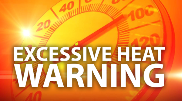
Stoddard County, MO - The National Weather Service in Paducah, KY has issued an EXCESSIVE HEAT WARNING until 8 p.m. Wednesday, June 15, 2022.
Affected Area
Portions of southeast Missouri, western Kentucky and southern Illinois
Description
...EXCESSIVE HEAT WARNING IN EFFECT UNTIL 8 PM CDT WEDNESDAY...
WHAT...Dangerously hot conditions with heat index values around 110 degrees Monday afternoon, and around 105 degrees Tuesday and Wednesday afternoon.
WHERE...Portions of southeast Missouri, western Kentucky and southern Illinois.
WHEN...Until 8 PM Wednesday.
IMPACTS...Extreme heat and humidity will significantly increase the potential for heat related illnesses, particularly for those working or participating in outdoor activities.
ADDITIONAL DETAILS...Heat index values were around 110 degrees Sunday afternoon. Overnight lows will only fall into the upper 70s to around 80. With three more days with maximum afternoon heat index values at least 105 degrees, this will result in dangerous conditions.
PRECAUTIONARY/PREPAREDNESS ACTIONS...
Drink plenty of fluids, stay in an air-conditioned room, stay out of the sun, and check up on relatives and neighbors. Young children and pets should never be left unattended in vehicles under any circumstances.
Take extra precautions if you work or spend time outside. When possible reschedule strenuous activities to early morning or evening. Know the signs and symptoms of heat exhaustion and heat stroke. Wear lightweight and loose fitting clothing when possible. To reduce risk during outdoor work, the Occupational Safety and Health Administration recommends scheduling frequent rest breaks in shaded or air conditioned environments. Anyone overcome by heat should be moved to a cool and shaded location. Heat stroke is an emergency! Call 9 1 1.

Stoddard County, MO - The National Weather Service in Paducah, KY have issued a Lake Wind Advisory for Stoddard County from 11 a.m. - 6 p.m. today for Stoddard County, MO.
Affected Area
Southeast Missouri and most of southern Illinois
Description
...LAKE WIND ADVISORY IN EFFECT FROM 11 AM THIS MORNING TO 6 PM CDT THIS EVENING...
WHAT...South winds around 15 mph with gusts in excess of 20 mph.
WHERE...Southeast Missouri and most of southern Illinois.
WHEN...From 11 AM CDT this morning until 6 PM CDT this evening.
IMPACTS...Strong winds and rough chop on area lakes will pose a heightened risk for recreational boaters enjoying the holiday weekend on area lakes and waterways.
ADDITIONAL DETAILS...Some lakes in the advisory include Clearwater Lake, Lake Wappapello, Rend Lake, Crab Orchard Lake, Kinkaid Lake, Cedar Lake, Little Grassy Lake, Devil's Kitchen Lake, and Lake of Egypt.
PRECAUTIONARY/PREPAREDNESS ACTIONS...
A Lake Wind Advisory indicates that winds will cause rough chop on area lakes. Small boats will be especially prone to capsizing.

Stoddard County, MO - The National Weather Service in Paducah, KY has issued a Lake Wind Advisory until 5 p.m. today for Stoddard County.
Affected Area
Portions of southwest Indiana, southeast Missouri, western Kentucky and southern Illinois
Description
...LAKE WIND ADVISORY IN EFFECT UNTIL 5 PM CDT THIS AFTERNOON...
WHAT...South winds 10 to 20 mph with gusts up to 35 mph.
WHERE...Portions of southwest Indiana, southeast Missouri, western Kentucky and southern Illinois.
WHEN...Until 5 PM CDT this afternoon.
IMPACTS...Strong winds and rough waves on area lakes will create hazardous conditions for small craft.
PRECAUTIONARY/PREPAREDNESS ACTIONS...
Boaters on area lakes should use extra caution since strong winds and rough waves can overturn small craft.

The National Weather Service in Paducah has issued a Severe Thunderstorm Warning for... West central New Madrid County in southeastern Missouri... Western Stoddard County in southeastern Missouri... Eastern Butler County in southeastern Missouri...
Until 1130 PM CDT.
At 1052 PM CDT, severe thunderstorms were located along a line extending from near Hendrickson to near Harviell to near Glennonville to Holcomb, moving north at 45 mph.
HAZARD...60 mph wind gusts and penny size hail.
SOURCE...Radar indicated.
IMPACT...Expect damage to roofs, siding, and trees.
Severe thunderstorms will be near... Poplar Bluff around 1100 PM CDT. Fisk and Dudley around 1110 PM CDT.
Other locations in the path of these severe thunderstorms include Puxico and Dexter.
PRECAUTIONARY/PREPAREDNESS ACTIONS...
For your protection move to an interior room on the lowest floor of a building.
To report severe weather, contact your nearest law enforcement agency. They will send your report to the National Weather Service office in Paducah.
HAIL THREAT...RADAR INDICATED; MAX HAIL SIZE...0.75 IN; WIND THREAT...RADAR INDICATED; MAX WIND GUST...60 MPH

Stoddard County, MO - Weather provided by Bagby Wealth Management - The National Weather Service in Paducah, KY has issued a Lake Wind Advisory in effect until 6 p.m. today.
Affected Area
Southwest Indiana, southeast Missouri, western Kentucky and southern Illinois
Description
...LAKE WIND ADVISORY IN EFFECT UNTIL 6 PM CDT THIS EVENING...
WHAT...South winds 15 to 20 mph with gusts up to 30 mph expected.
WHERE...Southwest Indiana, southeast Missouri, western Kentucky and southern Illinois.
WHEN...Until 6 PM CDT this evening.
IMPACTS...Strong winds and rough waves on area lakes will create hazardous conditions for small craft.
PRECAUTIONARY/PREPAREDNESS ACTIONS...
Boaters on area lakes should use extra caution since strong winds and rough waves can overturn small craft.

