ShowMe Weather
Subscribe to "ShowMe Weather"

ShowMe Gold Sponsors

Flood Watch Issued for Stoddard County until 9 a.m. Monday Morning
March 06th 2022 by Dee Loflin
Flood Watch Issued for Stoddard County until 9 a.m. Monday Morning

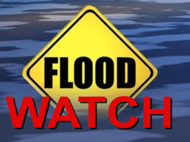
Stoddard County, MO - The National Weather Service in Paducah, KY has issued a Flood Watch until 9 a.m. Monday morning for Stoddard County, MO.

All of southern Illinois, southwest Indiana, southeast Missouri, and a portion of western Kentucky along a line from Paducah to Marion to Owensboro

Description

...FLOOD WATCH IN EFFECT THROUGH MONDAY MORNING...

WHAT...Flooding caused by excessive rainfall is possible.

WHERE...All of southern Illinois, southwest Indiana, southeast Missouri, and a portion of western Kentucky along a line from Paducah to Marion to Owensboro.

WHEN...Through 9 AM CST Monday morning.

IMPACTS...Excessive runoff may result in flooding of rivers, creeks, streams, and other low-lying and flood-prone locations. Flooding may occur in poor drainage and urban areas. Low-water crossings may be flooded.

ADDITIONAL DETAILS... - Multiple rounds of heavy rain and thunderstorm will fall over saturated soils. Rainfall totals of 1.5 of 2.5 inches can be expected with locally higher amounts. - http://www.weather.gov/safety/flood

PRECAUTIONARY/PREPAREDNESS ACTIONS...

You should monitor later forecasts and be alert for possible Flood Warnings. Those living in areas prone to flooding should be prepared to take action should flooding develop.

More Information

Heavy rain and thunderstorms will develop this afternoon and through the night as a warm front lifts through the region. Rainfall amounts of 1.5 to 2.5 inches can be expected through Monday morning, which will cause scattered flooding issues to develop.


Last Updated on March 06th 2022 by Dee Loflin


More from ShowMe Times:
Winter Storm Warning Moved Up to Noon to Today Through Thursday at 6 p.m.
February 23rd 2022 by Dee Loflin
Winter Storm Warning Moved Up to Noon to Today Through Thursday at 6 p.m.

Stoddard County, MO - The National Weather Service in Paducah,KY has moved the Winter Storm Warning to Noon today from 6 p.m.  It will be in effect until 6 p.m. on Thursday. 

Affected Area

All of southeast Missouri, the Purchase Area of western Kentucky and southern Illinois generally west of Interstate 57 and 24

Description

...WINTER STORM WARNING REMAINS IN EFFECT FROM NOON TODAY TO 6 PM CST THURSDAY...

WHAT...Moderate to heavy mixed precipitation, mainly freezing rain and some sleet. Ice accumulations one quarter of an inch or more, with some minor accumulations of sleet. The highest freezing rain accumulations are expected to be from the Ozark Foothills to far Western Kentucky.

WHERE...All of southeast Missouri, the Purchase Area of western Kentucky and southern Illinois generally west of Interstate 57 and 24.

WHEN...From 12 PM today to 6 PM Thursday.

IMPACTS...Scattered power outages and some tree damage are likely due to the ice. Travel could be hazardous. The hazardous conditions could impact the morning or evening commute.

ADDITIONAL DETAILS...Two rounds of wintry precipitation can be expected. The first will enter Southeast Missouri this afternoon and spread across all of the warning area for the evening and overnight hours. The second will be from midday Thursday on through the afternoon across the Ozark Foothills of Missouri into southwest Illinois. The rest of the warning area should see temperatures rise above freezing Thursday, and switch the precipitation to just rain.

PRECAUTIONARY/PREPAREDNESS ACTIONS...

If you must travel, keep an extra flashlight, food, and water in your vehicle in case of an emergency.


Last Updated on February 23rd 2022 by Dee Loflin


More from ShowMe Times:
Flood Watch Issued for Stoddard County Through Tuesday
February 21st 2022 by Dee Loflin
Flood Watch Issued for Stoddard County Through Tuesday

Stoddard County, MO - The National Weather Service in Paducah, KY has issued a Flood Watch beginning Monday through Tuesday.

Affected Area

Most of southeast Missouri, southern Illinois south of route 13, and all of western Kentucky

Description

...FLOOD WATCH REMAINS IN EFFECT FROM LATE TONIGHT THROUGH TUESDAY EVENING...

WHAT...Flash flooding caused by excessive rainfall continues to be possible.

WHERE...Most of southeast Missouri, southern Illinois south of route 13, and all of western Kentucky.

WHEN...From late tonight through Tuesday evening.

IMPACTS...Excessive runoff may result in flooding of rivers, creeks, streams, and other low-lying and flood-prone locations.

ADDITIONAL DETAILS... - Heavy rain is forecast to fall on recently saturated ground. Widespread amounts of 2 to 3 inches are forecast, and locally higher totals are possible.

PRECAUTIONARY/PREPAREDNESS ACTIONS...

Be sure to monitor updated forecasts and be prepared to take action should Flash Flood Warnings be issued.


Last Updated on February 21st 2022 by Dee Loflin


More from ShowMe Times:
Flood Warning Issued for Stoddard County
February 17th 2022 by Dee Loflin
Flood Warning Issued for Stoddard County

Stoddard County, MO - The National Weather Service in Paducah, KY has issued a Flood Warning for Stoddard County from 10:13 a.m. - 7:00 p.m.

Affected Area

Portions of western Kentucky and southeast Missouri, including the following areas, in western Kentucky, Fulton. In southeast Missouri, Bollinger, Butler, Carter, New Madrid, Ripley, Stoddard and Wayne

Description

...FLOOD WARNING IN EFFECT UNTIL 7 PM CST THIS EVENING...

WHAT...Urban area and Small stream flooding caused by excessive rainfall is expected.

WHERE...Portions of western Kentucky and southeast Missouri, including the following areas, in western Kentucky, Fulton. In southeast Missouri, Bollinger, Butler, Carter, New Madrid, Ripley, Stoddard and Wayne.

WHEN...Until 700 PM CST Thursday.

IMPACTS...Flooding of rivers, creeks, streams, and other low-lying and flood-prone locations is imminent or occurring. Streams continue to rise due to excess runoff from earlier rainfall. Low-water crossings are inundated with water and may not be passable. It will take several hours for all the water from these storms to work through local drainage systems in urban areas.

ADDITIONAL DETAILS... - At 1004 AM CST, Cooperative observers and public reports indicated heavy rain in the warned area due to heavy rain showers and scattered thunderstorms. Flooding is ongoing or expected to begin shortly. Between 1 and 3 inches of rain have fallen. - Additional rainfall amounts of 1 to 2 inches are possible in the warned area. - Some locations that will experience flooding include... Poplar Bluff, Sikeston, Dexter, Portageville, New Madrid, Doniphan, Bernie, Marble Hill, Lilbourn, Lake Wappapello State Park, Greenville, Hunter-Dawson State Historic Site, Malden, Gideon, Morehouse, Puxico, Parma, Naylor, Matthews and Marston. - http://www.weather.gov/safety/flood

PRECAUTIONARY/PREPAREDNESS ACTIONS...

Turn around, don't drown when encountering flooded roads. Most flood deaths occur in vehicles.

In hilly terrain there are hundreds of low water crossings which are potentially dangerous in heavy rain. Do not attempt to cross flooded roads. Find an alternate route.

Flooding is occurring or is imminent. It is important to know where you are relative to streams, rivers, or creeks which can become killers in heavy rains. Campers and hikers should avoid streams or creeks.

Please report observed flooding to local emergency services or law enforcement and request they pass this information to the National Weather Service when you can do so safely.

More Information

Periods of heavy rain overnight and this morning have produced widespread one to two inches of rain over the southeast Missouri foothills and further east toward the southeast Missouri Delta region. Periods of heavy rain is expected to persist into the early to middle afternoon hours and work southeast toward the bootheel region.


Last Updated on February 17th 2022 by Dee Loflin


More from ShowMe Times:
Winter Storm Warning Issued for Stoddard County
February 01st 2022 by Dee Loflin
Winter Storm Warning Issued for Stoddard County

Stoddard County, MO - The National Weather Service in Paducah, KY has issued a WINTER STORM WARNING!

Affected Area

Portions of southeast Missouri and southern Illinois. This area is generally along and west of a line from Poplar Bluff and Cape Girardeau Missouri to Marion and Albion Illinois

Description

...WINTER STORM WARNING IN EFFECT FROM NOON WEDNESDAY TO 6 AM CST FRIDAY...

WHAT...Heavy mixed precipitation is possible. Total snow and sleet accumulations of 2 to 5 inches, and ice accumulations of one tenth of an inch with locally higher amounts possible.

WHERE...Portions of southeast Missouri and southern Illinois. This area is generally along and west of a line from Poplar Bluff and Cape Girardeau Missouri to Marion and Albion Illinois.

WHEN...From Wednesday afternoon through late Thursday night.

IMPACTS...Power outages and tree damage are possible due to the ice. Travel could be nearly impossible and should be avoided unless absolutely necessary. The hazardous conditions could impact those travelers during the morning or evening commutes, especially on Thursday.

PRECAUTIONARY/PREPAREDNESS ACTIONS...

Monitor the latest forecasts for updates on this situation.


Last Updated on February 01st 2022 by Dee Loflin


More from ShowMe Times:
Winter Storm Watch Issued for Stoddard County Beginning Wednesday
January 31st 2022 by Dee Loflin
Winter Storm Watch Issued for Stoddard County Beginning Wednesday

Stoddard County, MO - The National Weather Service in Paducah, KY has issued a WINTER STORM WATCH from Wednesday evening through late Thursday night.

DESCRIPTION

...WINTER STORM WATCH IN EFFECT FROM WEDNESDAY EVENING THROUGH LATE THURSDAY NIGHT...

WHAT...Heavy mixed precipitation is possible with total snow accumulations of up to two inches, and ice accumulations of two tenths to four tenths of an inch possible.

WHERE...For portions of southeast Missouri and southern Illinois. This area is along and west of a line from Doniphan, Poplar Bluff, Cape Girardeau Missouri onward to Carbondale, McLeansboro, and Wayne City Illinois.

WHEN...From Wednesday evening through late Thursday night.

IMPACTS...Power outages and tree damage are likely due to the ice. Travel could be nearly impossible and should be avoided unless absolutely necessary. The hazardous conditions could impact those travelers during the morning or evening commutes.

ADDITIONAL DETAILS...Prolonged power outages may occur where significant ice accumulations develop.

PRECAUTIONARY/PREPAREDNESS ACTIONS...

Monitor the latest forecasts for updates on this situation.

Weather provided by Bagby Wealth Management!


Last Updated on January 31st 2022 by Dee Loflin


More from ShowMe Times:
Special Weather Statement Issued for Stoddard County Tonight and Early Wednesday
January 25th 2022 by Dee Loflin
Special Weather Statement Issued for Stoddard County Tonight and Early Wednesday

Stoddard County, MO - The National Weather Service in Paducah, Kentucky has issued a Special Weather Statement.  Wind chills near zero tonight (Tuesday) and early Wednesday.

Description

...Wind Chills Near Zero Late Tonight and Early Wednesday...

Arctic high pressure will bring another shot of bitterly cold air into our region over the next 24 hours. Temperatures tonight will bottom out from 5 to 15 degrees, but north winds around 10 mph will make it feel even colder.

Around daybreak Wednesday, wind chills will be from zero to 5 below along and northwest of a line from Evansville Indiana to Cape Girardeau Missouri. Wind chills to the southeast of that line will bottom out from zero to 5 above.

Regardless of the exact value, these wind chills will impact morning commuters and school children. Dress in layers, wear a hat or hood, and protect outdoor pets. The lowest wind chills will occur from about 3 AM to 10 AM, then rise into the 20s Wednesday afternoon.


Last Updated on January 25th 2022 by Dee Loflin


More from ShowMe Times: