
Dee Loflin, SMT Manager/Editor
Also, by order of the Governor, all flags at all State and government offices will be flown at half-staff, in Butler County only, from sunrise Sunday, December 15, 2013, until sunset on Friday, December 20, 2013, in memory of Staff Sergeant Eric William Summers.
Your office is responsible for distributing this information throughout your department for compliance with this order on December 14, 2013.
Summers, age 32, of Poplar Bluff, was a United States Marine who died on Nov. 13 while serving his country at Camp Pendleton, Calif. In addition, Nixon has ordered that the U.S. and Missouri flags at all state buildings in Butler County be flown at half-staff from Dec. 15 to Dec. 20.
“We honor the bravery and dedication of Marine Staff Sergeant Summers, and I ask all Missourians to remember his sacrifice when they see the lowered flags,” Nixon said. “Our thoughts and prayers are with his family and friends.”
"Summers, who served 13 with the Marines, was assigned to the 3rd Marine Air Wing, Marine Wing Support Group 37, Marine Wing Support Squadron 372 at Marine Corps Base Camp Pendleton. His awards and decorations include the Navy Commendation Medal, with Combat Distinguishing Device in lieu of third award; the Navy and Marine Corps Achievement Medal; and the Good Conduct Medal in lieu of third award."
"Four bomb-removal technicians killed at Camp Pendleton during a training exercise, including Summers, two Marines from California, and one from Louisiana. The two Californians killed were 28-year-old Staff Sgt. Mathew R. Marsh of Long Beach, who had been a Marine since 2003, and 27-year-old Sgt. Miguel Ortiz of Vista, a Marine since 2006. Also killed was 31-year-old Gunnery Sgt. J. Mullins of Bayou L’Ourse, La., an 11-year Marine Corps veteran. A Navy Hospital Corpsman and two Marines near the accident suffered minor injuries in the explosion."
"Summers is being returned to Southwest Missouri tonight, and his community has turned out to honor his return so that he may be laid to rest. More than 2,300 American flags lined the streets of Poplar Bluff by Wednesday night. Local news agencies report that hundreds of volunteers also put American flags into the ground from where the services will take place to where summers will be buried."
Dee Loflin, SMT Manager/Editor
In December, the Army National Guard's current strength at more than 107 percent of its allocated force, while the Missouri Air National Guard is flying high with a current strength of more than 103 percent, said Maj. Gen. Steve Danner, the adjutant general.
"These numbers reflect the patriotism of the people of Missouri, as well as the professionalism of the state's 11,500 Soldiers and Airmen," Danner said. "Simply put, people want to serve in the Missouri National Guard. Whether we're talking about flood responses in Missouri or firefights in Afghanistan, our men and women are on the front lines, protecting good people from bad things."
In November, the Missouri Army National Guard ranked sixth among the nation's 54 National Guards in strength and seventh in personnel readiness, said Col. John Oberkirsch, director of personnel and manpower for the Missouri National Guard. Oberkirsch credits the superior performance to increased communication and empowering senior commands.
"Our chief of staff, Col. David Boyle, has been personally visiting armories on a quarterly basis," Oberkirsch said. "His visits have started a dialogue, which has helped raise awareness on the part of our administrative officers and readiness staffers about the organization's strategic plan, where we want to go, and how we want to get there."
Each state is authorized a certain number of Soldiers and Airmen, but may recruit above that number, Oberkirsch said. Because roughly 10 percent of every unit's personnel are going through training schools at any given time, recruiting over authorized strength increases flexibility by ensuring commanders have more Soldiers and Airmen trained and ready to go.
The Missouri Air National Guard's recruiting and retention superintendent, Senior Master Sgt. Carol Walsh, said her team is focused on recruiting and retaining motivated, talented Airmen.
"With our B-2 mission at Whiteman AFB, our C-130 mission in St. Joseph, and our Air Operations Group in St. Louis, the Missouri Air National Guard offers a wide variety of career fields from aerospace maintenance to cyber operations," Walsh said. "Our force is better now than it has ever been, and we serve a critical role in the total Air Force mission. Maintaining our strength and readiness is vital to that mission."
Success in recruiting and retention have a direct role in ensuring readiness, but Oberkirsch said the credit for the Missouri National Guard's current outstanding performance is the result of departments across the organizations working together.
"We've seen great synergy between commands and recruiting in both retention and recruiting," Oberkirsch said. "The commands have a larger role in the retention part of strength, but rely on the recruiting section for technical expertise and support. Our recruiters are responsible for new accessions, but rely on the technical support of our units."
After more than 12 years of war and dozens of state emergencies, it is critical that the Missouri National Guard retain its current generation of seasoned, battle-tested Soldiers and Airmen, Oberkirsch said. That is even more important in light of the determination of Gen. Frank Grass, chief of the National Guard Bureau and member of the Joint Chiefs of Staff, that the Guard must remain an operational rather than strategic reserve.
"We don't want to lose that experience" Oberkirsch said. "Our state is at a high state of readiness and stands ready to carry out our mission as assigned by the governor and president."
For more information about the Missouri National Guard, please visit www.moguard.com and our social media sites: www.facebook.com/Missouri.National.Guard; www.twitter.com/Missouri_NG; www.youtube.com/MoNationalGuard; www.myspace.com/missouri_ng; www.flickr.com/photos/missouriguard; www.moguard.com/blog; www.pinterest.com/monationalguard/; www.dvidshub.net/unit/MONGPAO

Dee Loflin, SMT Manager/Editor
Southeast Missouri - The National Weather Service in Paducah, Kentucky has issued a Winter Weather Statement. A QUICK SHOT OF SNOWFALL EXPECTED TONIGHT AND VERY EARLY TUESDAY OVER PART OF THE QUAD STATE REGION...
A FAST MOVING WEATHER SYSTEM WILL MOVE ACROSS PARTS OF THE QUAD STATE REGION TONIGHT AND VERY EARLY TUESDAY. THIS WILL BRING A SMALL ACCUMULATION OF ADDITIONAL SNOW MAINLY TO NORTHERN PARTS OF THE AREA.
MEASURABLE SNOW IS EXPECTED TO DEVELOP AND MOVE ACROSS THE OZARK FOOTHILLS IN SOUTHEAST MISSOURI... TOWARD THE MISSISSIPPI RIVER NEAR PERRYVILLE MISSOURI... BY MID EVENING. THIS SNOW IS EXPECTED TO THEN SPREAD EASTWARD ACROSS SOUTHERN ILLINOIS AND INTO SOUTHWEST INDIANA BY MIDNIGHT. THE SNOW WILL CONTINUE WORKING ITS WAY INTO NORTHWEST KENTUCKY AND THE REMAINDER OF SOUTHWEST INDIANA THROUGH SUNRISE ON TUESDAY.
THE HIGHEST SNOWFALL AMOUNTS SHOULD BE BETWEEN AN INCH AND AN INCH AND A HALF... AND THAT SHOULD OCCUR ROUGHLY ALONG AND NORTH OF A BENTON ILLINOIS... TO MOUNT CARMEL ILLINOIS... TO SANTA CLAUS INDIANA LINE.
AMOUNTS APPROACHING AN INCH MAY BE POSSIBLE AS FAR SOUTH AS AN AVA ILLINOIS... TO CARMI ILLINOIS... TO CHRISNEY INDIANA LINE... WHILE LESSER AMOUNT TO JUST A LIGHT COATING ARE EXPECTED TOWARD THE SOUTHERN EXTENT OF THE BAND... FROM NEAR DONIPHAN MISSOURI... TOWARD VIENNA ILLINOIS... AND GREENVILLE KENTUCKY.
THE FORECASTED SNOW AMOUNTS SHOULD HAVE LITTLE IMPACT ON AREA TRAVEL... SAVE FOR REDUCED VISIBILITIES LESS THAN A MILE IN HEAVIER SNOW BANDS. THE GREATEST CHANCE OF SEEING A REDUCTION OF VISIBILITIES DUE TO SNOW WILL BE ALONG THE INTERSTATE 64 CORRIDOR IN SOUTHERN ILLINOIS AND SOUTHWEST INDIANA.
THIS SNOW WILL COMPLETELY EXIT THE REGION BY OR BEFORE 10 AM CST ON TUESDAY.
Dee Loflin, SMT Manager/Editor
THE NATIONAL WEATHER SERVICE IN PADUCAH HAS ISSUED A WINTER WEATHER ADVISORY FOR FREEZING DRIZZLE WHICH IS IN EFFECT UNTIL 3 AM CST MONDAY.
* TIMING: FREEZING DRIZZLE COMBINED WITH FREEZING FOG ARE EXPECTED TO PRODUCE SLICK SPOTS ON AREA ROADWAYS THIS EVENING INTO THE EARLY OVERNIGHT HOURS. AT THE TIME OF THIS ISSUANCE TEMPERATURES AT OR BELOW FREEZING ARE BEING REPORTED GENERALLY NORTH AND WEST OF A LINE FROM FULTON TO PADUCAH TO MADISONVILLE KENTUCKY. HOWEVER... AS THE EVENING PROGRESSES THE FREEZING LINE IS EXPECTED TO MIGRATE SOUTH AND EAST TO THE SOUTHERN PENNYRILE REGION OF WESTERN KENTUCKY.
* MAIN IMPACT: THE MAIN IMPACT WILL BE SLICK SPOTS ON AREA ROADWAYS AND ELEVATED SURFACES SUCH AS BRIDGES AND OVERPASSES THAT WILL BE VERY DIFFICULT TO DETECT.
PRECAUTIONARY/PREPAREDNESS ACTIONS...
A WINTER WEATHER ADVISORY MEANS THAT PERIODS OF FREEZING DRIZZLE WILL CAUSE TRAVEL DIFFICULTIES. BE PREPARED FOR SLIPPERY ROADS AND LIMITED VISIBILITIES... AND USE CAUTION WHILE DRIVING.

Dee Loflin, SMT Manager/Editor
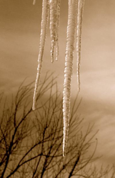
Southeast Missouri - WINTER WEATHER ADVISORY IN EFFECT UNTIL 5 PM CST THIS AFTERNOON...
THE NATIONAL WEATHER SERVICE IN PADUCAH HAS ISSUED A WINTER WEATHER ADVISORY FOR VERY LIGHT FREEZING RAIN OR DRIZZLE... WHICH IS IN EFFECT UNTIL 5 PM CST THIS AFTERNOON.
* PRECIPITATION MAY BEGIN AS A VERY LIGHT WINTRY MIX OVER SOUTHWEST PORTIONS OF SOUTHWEST INDIANA AND SOUTHERN ILLINOIS. PRECIPITATION SHOULD CHANGE OVER TO MAINLY FREEZING DRIZZLE BY MID MORNING RAIN THOUGH. OVER WESTERN KENTUCKY... FREEZING DRIZZLE WILL BE POSSIBLE MUCH OF THE DAY.
* AS TEMPERATURES REMAIN BELOW FREEZING... FREEZING DRIZZLE WILL PUT A LIGHT COATING OF ICE ON MOST ALL UNTREATED SURFACES. EVEN THOUGH THE ACCUMULATIONS AMOUNTS ARE VERY LIGHT IT ONLY TAKES A TRACE OF ICE TO CREATE HAZARDOUS DRIVING CONDITIONS.
PRECAUTIONARY/PREPAREDNESS ACTIONS...
A WINTER WEATHER ADVISORY MEANS THAT PERIODS OF SNOW... SLEET... OR FREEZING RAIN WILL CAUSE TRAVEL DIFFICULTIES. BE PREPARED FOR SLIPPERY ROADS AND LIMITED VISIBILITIES... AND USE CAUTION WHILE DRIVING.

